 Larry W.
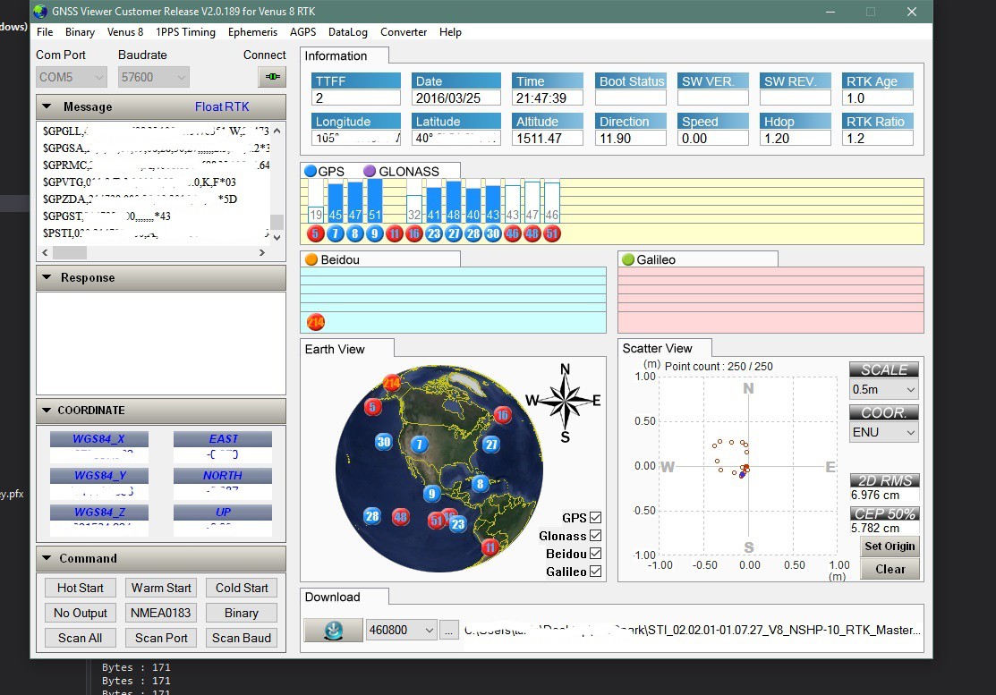
Finally have the RTK GPS working properly using the NTRIP client I wrote in C#. I was able to draw a rectangle that was about 12 or so inches on a side by moving the antenna. See the image below, bottom right corner, red circles.
I am using a CORS station about 25 miles away. The recommended maximum distance is about 10 miles. So I will be purchasing another RTK GPS module from NavSpark and setting up my own base station. However the TCP serial NTRIP client using the Fona does work as well as the TCP client over WiFi/Ethernet.
Hopefully the snow will melt enough and the roads will dry enough to be able to do some outside tests of route finding/way point finding.
Discussions
Become a Hackaday.io Member
Create an account to leave a comment. Already have an account? Log In.