 Christoph
I've implemented all those coordinate conversions and added an "objects" widget that can be enabled in the on-screen menu. So far, this widget just displays the centroids of each sky patch as a little triangle. That a huge step forward, because the patches' centroids are stored in terms of right ascension and declination - just like the real objects I want to read from a database. Here's a typical picture:
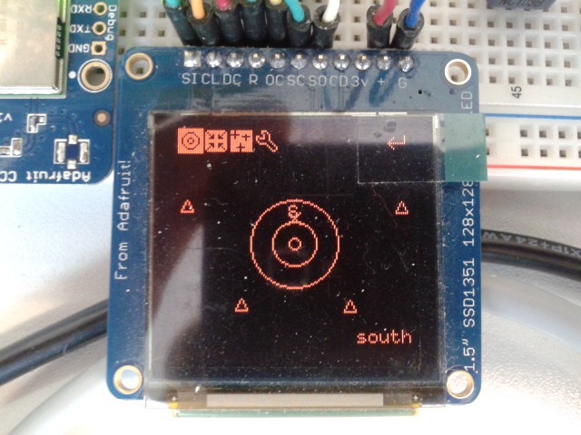 At the top, you can see the menu with the "Telrad Circles", "Target" and "Objects" icons activated (the first three from left to right). The "S" marker near the center is an artificial marker I needed for debugging, and it marks the horizontal south. The Target is "south" as well, indicated by the small "x" just below the "S".
When I move the device (lift up one edge) or turn the artificial azimuth potentiometer, the screen shifts or tilts accordingly and new sky patches are reloaded on the fly. CPU load is about 55 % depending on what is displayed, and I still draw at 25 fps.
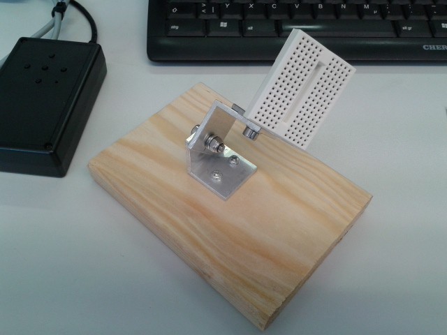
I've also built a small dummy dobson mount which will hold the accelerometer and the artificial azimuth pot as long as I don't have anything better. It's made of 30 x 30 mm L-shaped aluminium, a piece of wood and the usual nuts and bolts (M5 x 16 screw - washer - aluminium - aluminium - spring washer - washer - self-locking nut):
 Coming up next: the third attempt at object databases or a battery plus charger circuit for the input device.
Discussions
Become a Hackaday.io Member
Create an account to leave a comment. Already have an account? Log In.