 caver.adam
Over the last week I had ideas that could be added to this scanner once a proof of concept is made.
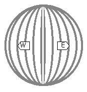
1) Have the scanner use a more complicated algorithm for selecting points. The current method collects a lot of points close together near the poles, and the points near the equator are farther apart.
2) Have the laser scanner change the angle between shots based on the distance to the target. The scanner can be set to an arc distance between shots instead of by an angle distance between shots. Example: at 36 inches we only need to capture every 1.5 degrees to get a measurement to measurement spacing (arcdistance) of 1 inch; at 240 inches (20ft) we need to capture every 0.25 degrees to get a the same spacing of 1 inch. Decreasing the number of data points at close range can speed up the scan rate while providing a consistently space point cloud across the entire scan.
- arc distance = ((2*pi)/(ShotsPer360Degrees))*LaserDistance
- ShotsPer360Degrees >= 2*pi*LaserDistance/DesiredArcDistance
Discussions
Become a Hackaday.io Member
Create an account to leave a comment. Already have an account? Log In.