The Why and the What:
Discuss the Challenge the project addresses:
America is big, climate change is serious, and systematic change is hard.
In order to meet net zero climate goals in cities we will need to fundamentally change how we move through our built environment, from cars which are polluting across a swath of metrics to human centric design systems like bikes + public transit. Although America sprawls, American cities are an exception, and a rare case where bike transit could replace or sufficiently reduce car transit due to shorter distance and more dense spaces. If most car trips in cities could be replaced by 15 min bike trips, why aren't they? Specifically in SF, the testing ground of this project, the city is no more than 7x7 miles.
The problem is that biking in urban landscapes can be dangerous, challenging and unpleasant. The main culprit of this is that American cities have been designed for cars, such that moving beyond this mode of transit requires genuine strategy and innovation to make biking a preferable mode of transit. Biking next to cars is a physical danger because of insufficient infrastructure, a health hazard due to the particles from tires as well as the exhaust, and a physiological drain due to the energy of navigating systems designed for other transit modes.
Discuss how the project will alleviate or solve the problem that the project addresses
So what do we do about it? We create a strategy to make cities more amenable for bikers by changing the way cities are designed. This requires a bike gizmo, urban experiment, an engaged community and a convincing dataset.
“Bright block” is the name of this project, which has several technical components which all come together to form three project phases, 1. Characterize, 2. Share, 3. Change.
1st Phase: Characterize
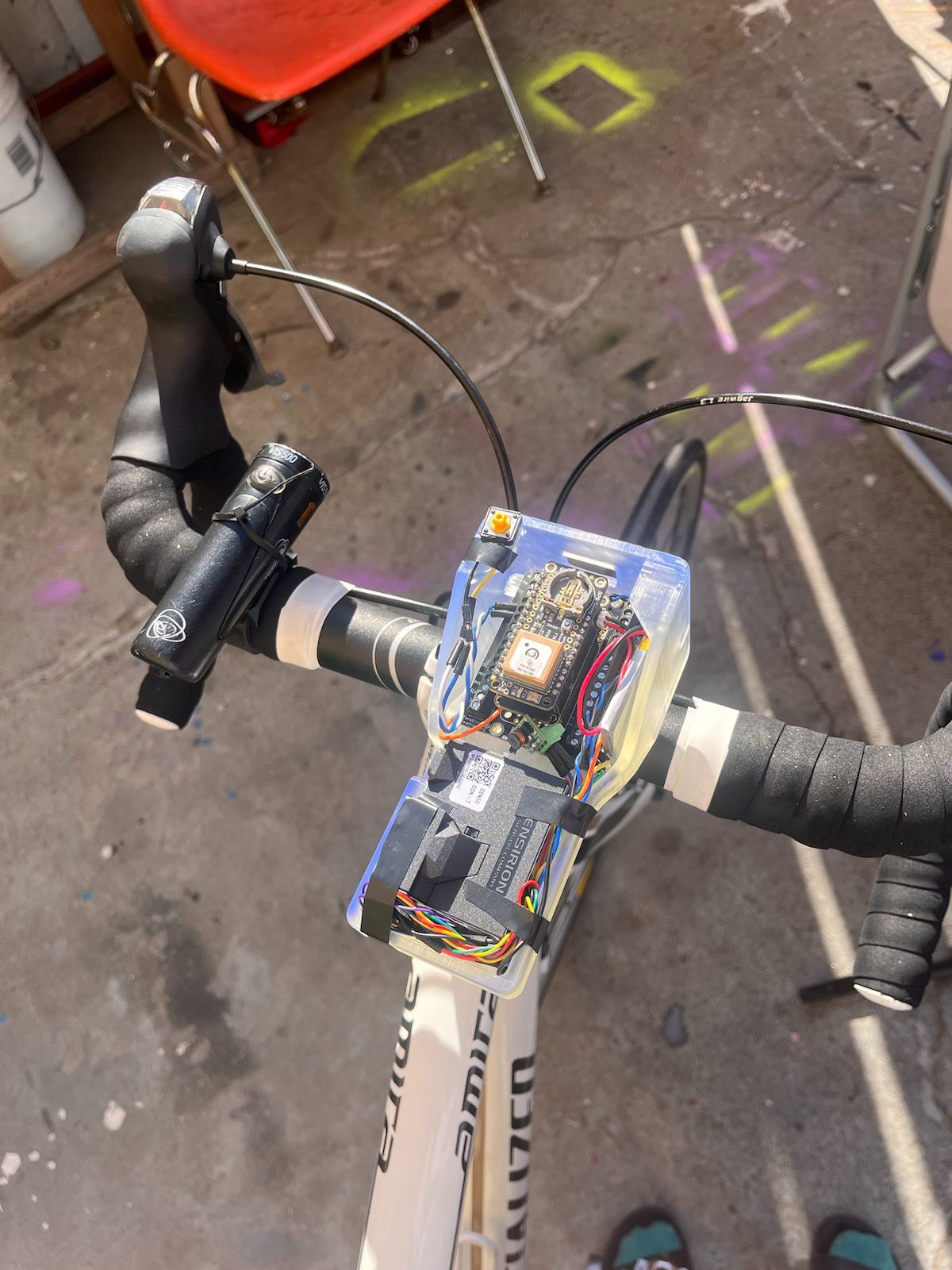
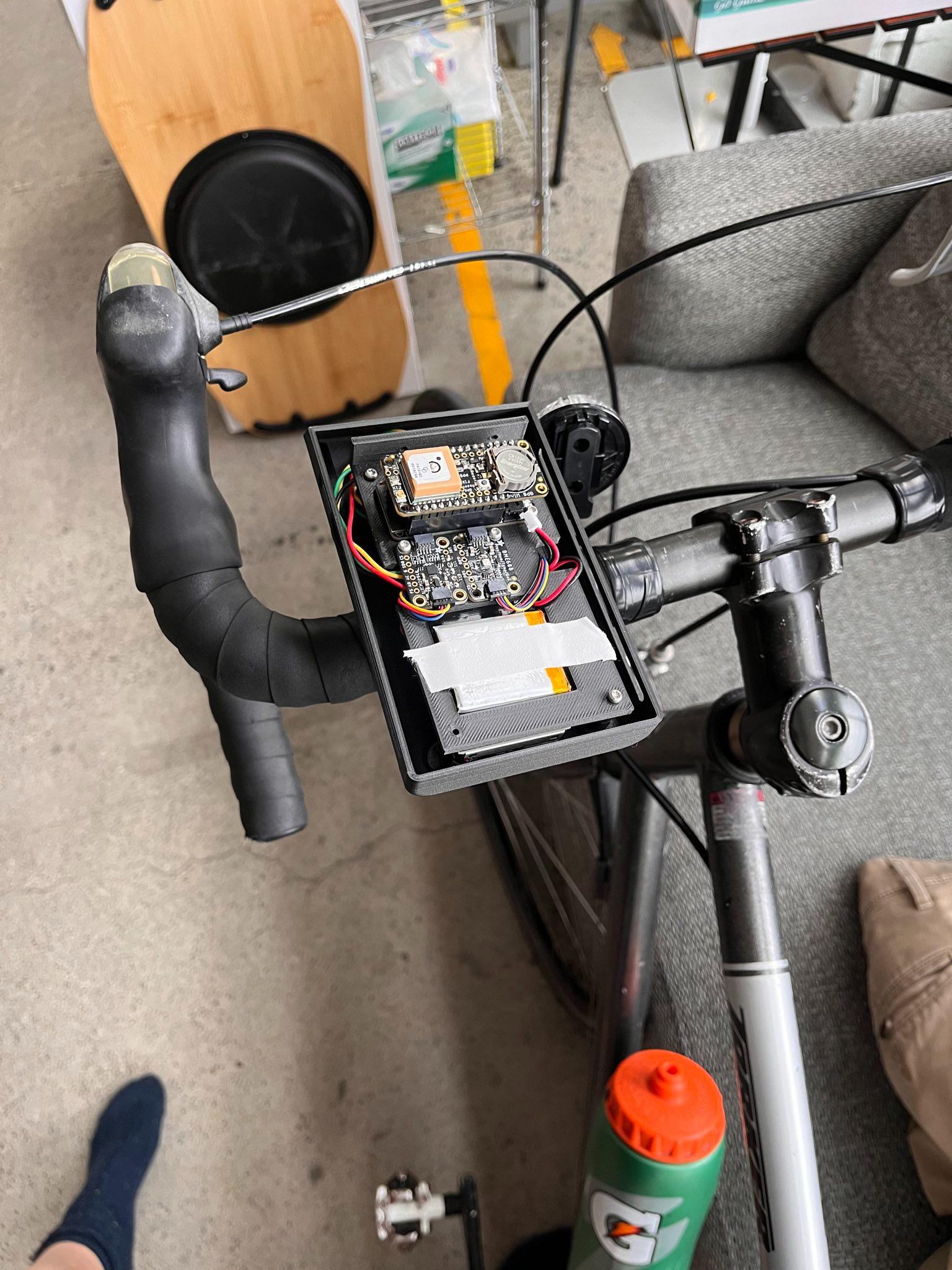
Welcome to the bike Gizmo! This is the hardware component of this project, it’s - well mostly - a bike light, (i.e. the name, bright block)! The bike light is a made at cost gizmo which is also an esp32 based climate monitor built to capture and characterize several aspects of biking in the city:
- The health impact to the person Biking (which is important ! (because most climate data in cities is building or gps static, and not directly traceable to a person, and characterizing impact per person is a key legislative impetus))
- Through validated and relevant data (PM2.5, NO’s, other VOC index)
- Active “car incident reporting” i.e. flagging of dangerous intersections or locations
- Allows accurate prioritizations/key targets for infrastructure upworks (vs the current standard @ sf which is the high injury network which is taken from hospital data)
- Passively capturing state of the biking infrastructure
- For building better bike specific mapping capacity
Most of the technical development and the writetup will focus here!
2st Phase: Share
A data transmission pipeline will take this data and amalgamate it into a platform which is fun and engaging. Maps of routes in terms of data collected can be plugged into strava. Community flagging of dangerous intersections can be made.
This is the paper crane rule, when people make data themselves they are more attached and engaged with it. I.e. Make it fun to care. Make sure the data is worth caring about.
3rd Phase: Change
Partner with local collaborations like the SFMTA, bike collation, ect to push board of supervisors to implement changes on the specific identified intersections. Track progress of local rollouts of bike infrastructure like the donut policy on Valencia street.
Project Scope and Overview:
Functional Diagram of Device:
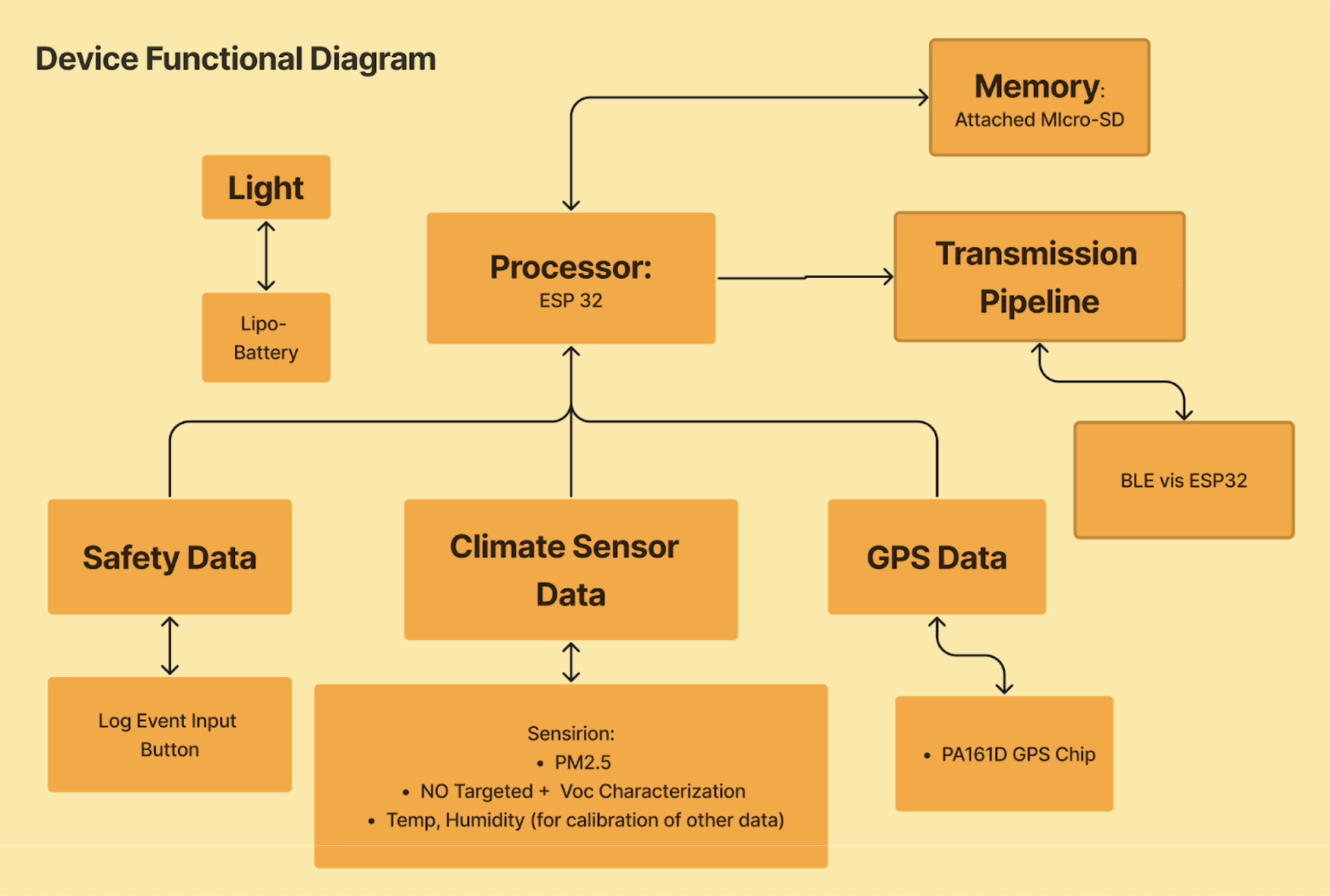
This graphic is the version as per project version Twin peaks!
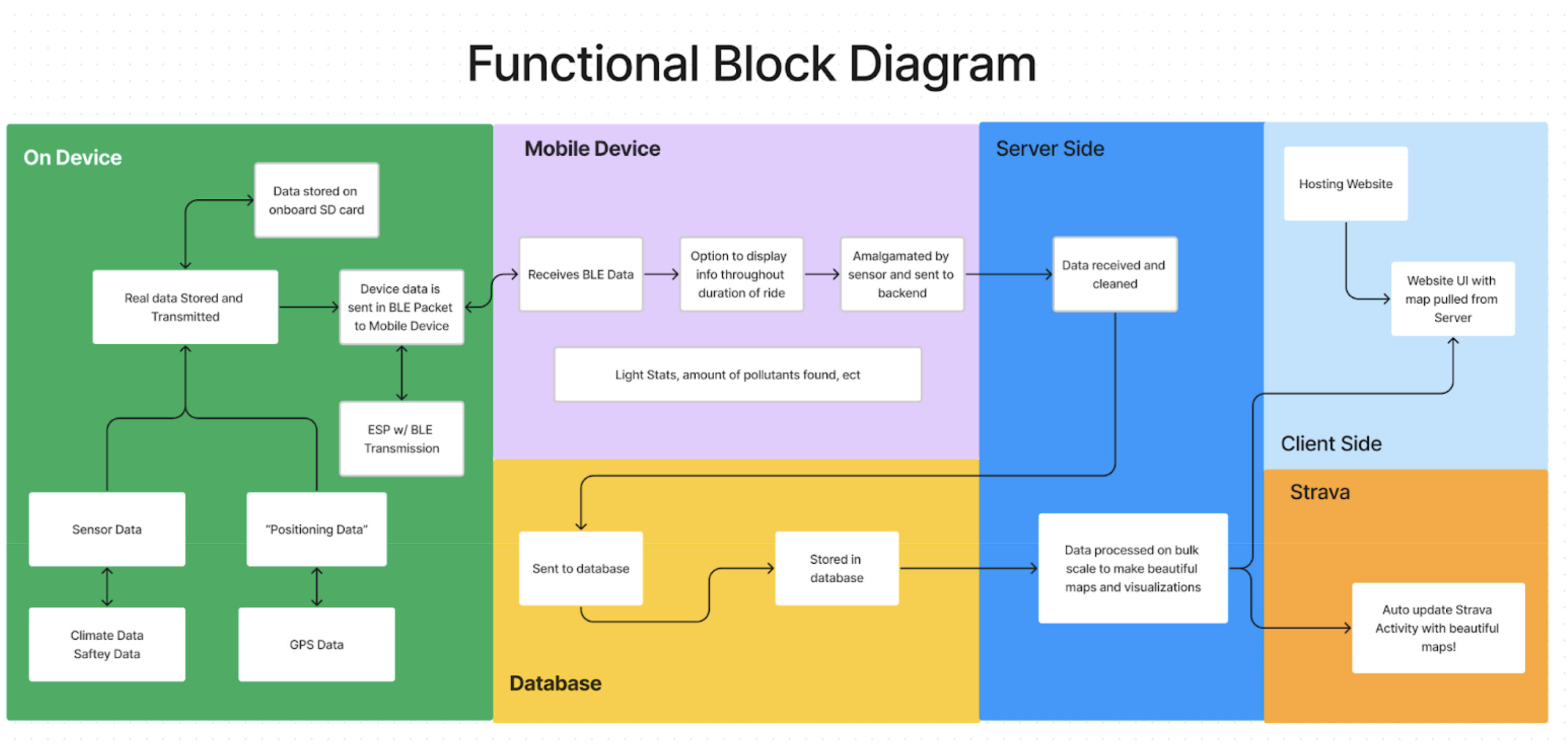
Data Handling through different Layers:
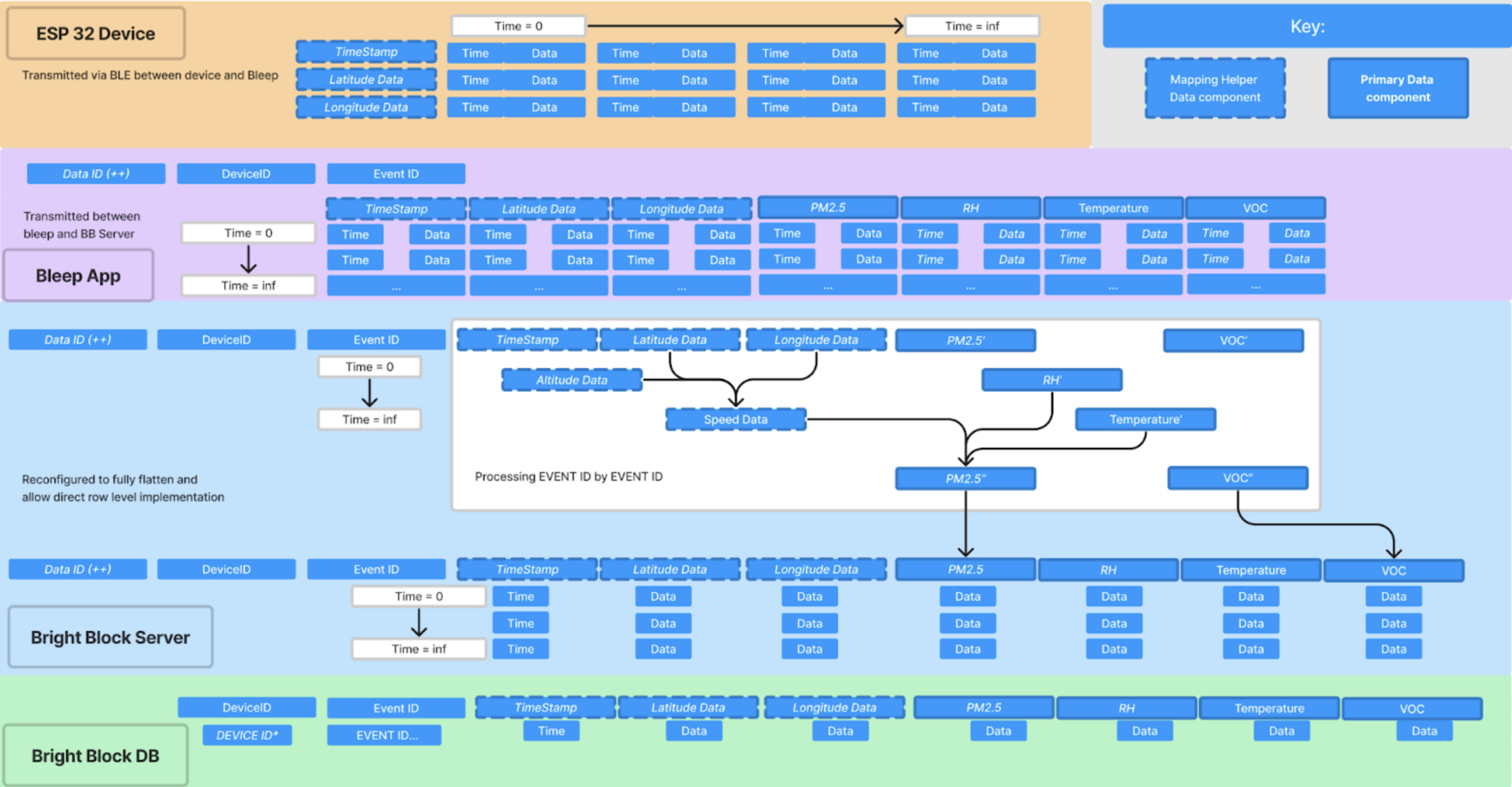
This graphic is the version as per project versions Golden Gate + Twin peaks!
Ideal Outputs!
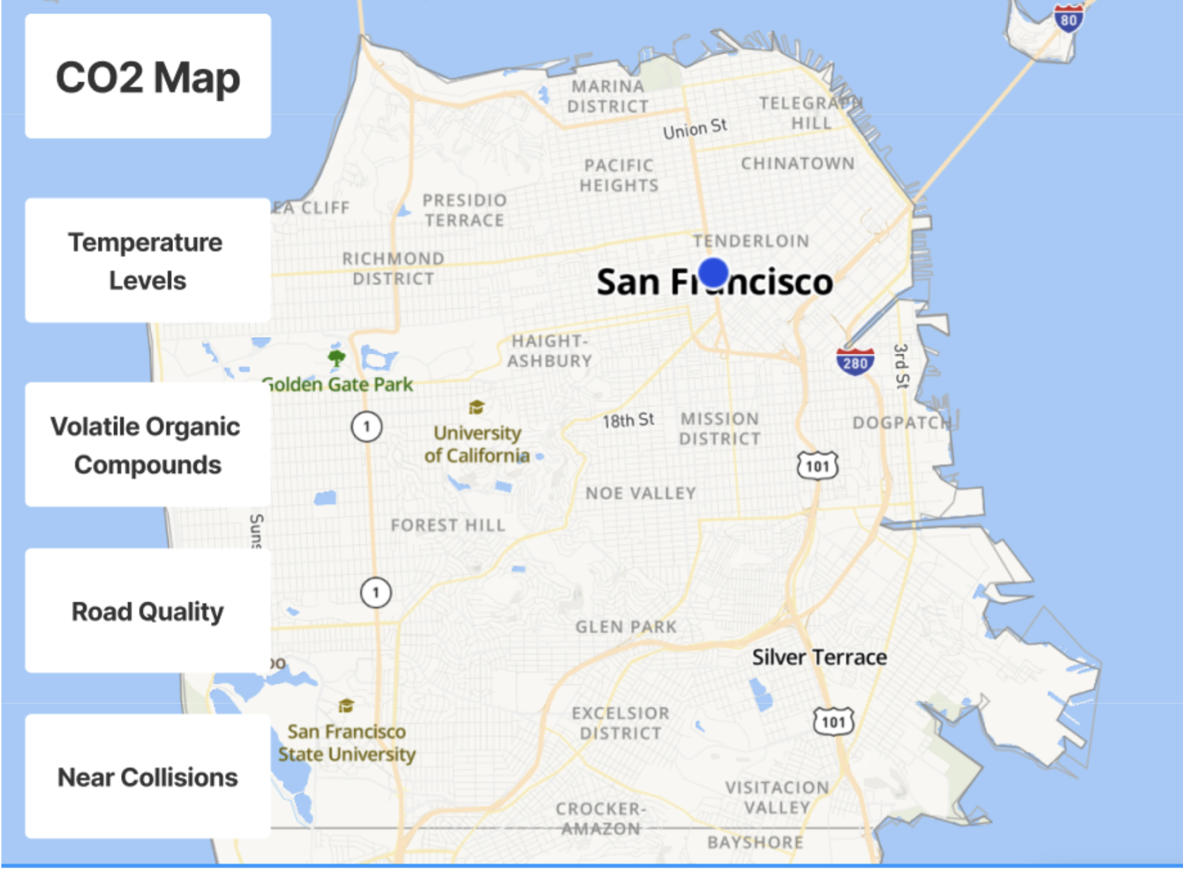
This provides an ideal mockup for the type of community mapping this project could enable!
 Kelsey