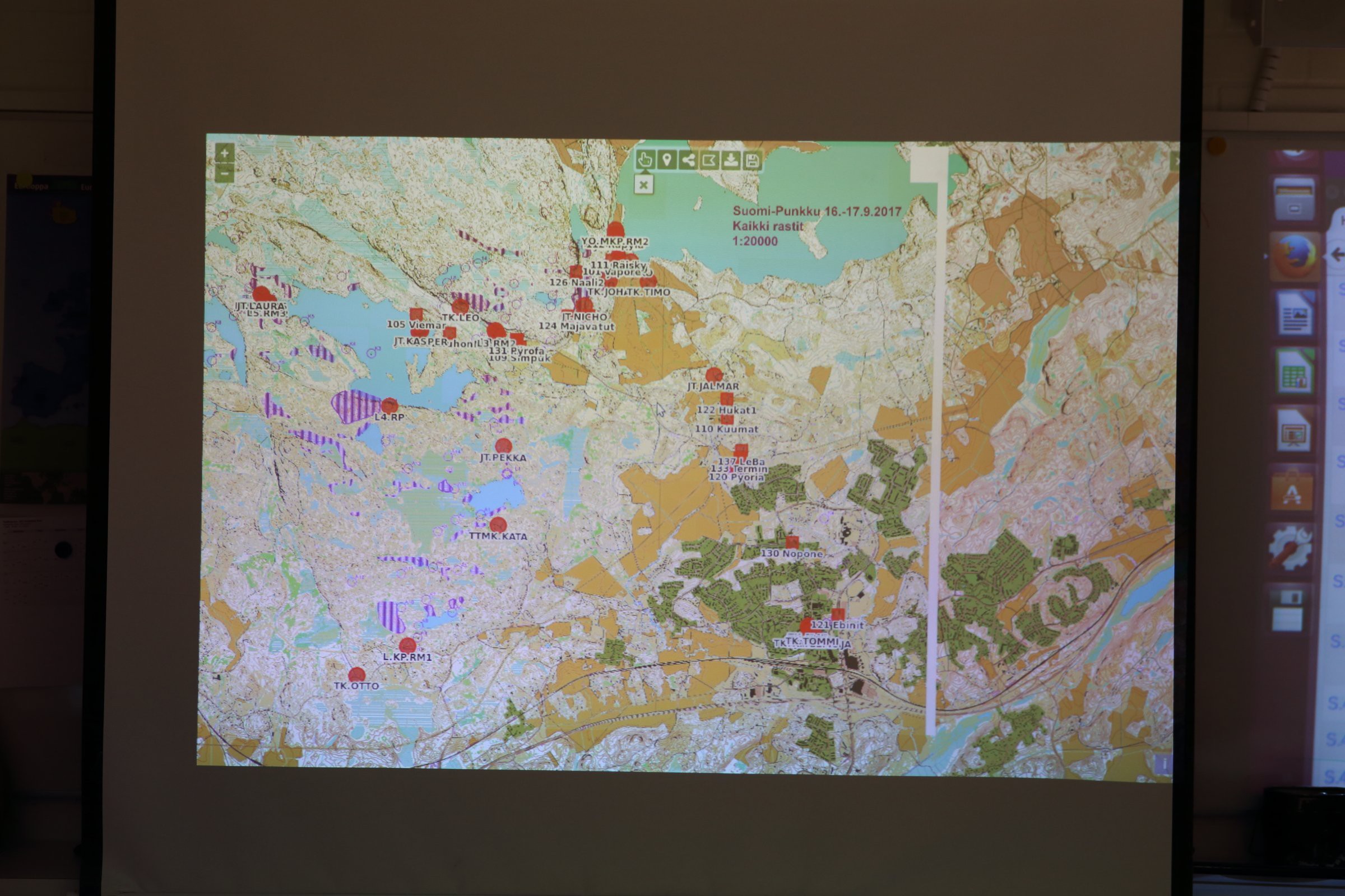
We had data from the radio network, but the system to visualize the data was missing. One of our team members took an appointment and created one from scratch.
The online system consists of a PostGIS database to store the incoming packets and an Openlayers engine in the front to visualize all in the browser.
The project began in March 2017 and required numerous weekends of 100% programming with extraordinary attention to detail and the big picture in the same time.
The result was astonishing. The system received position reports as $POS messages (format created during the project), saved the data and updated it in real time on the map. The system was deemed stable enough to be ready for production.
Discussions
Become a Hackaday.io Member
Create an account to leave a comment. Already have an account? Log In.