 Mar Bartolome
We live in London, which is a huge city. Moving around can be a challenge with 11 different underground lines and over 600 bus lines (no joking! https://en.wikipedia.org/wiki/London_Buses).
Luckily, the TFL (organization managing all things Transport For London) does a wonderful job at having real time data for the status of the transport, and not only that, it also exposes that data though an API. Then other wonderful apps such as Google Maps or Citymapper can make use of it to help you find your way around the city.
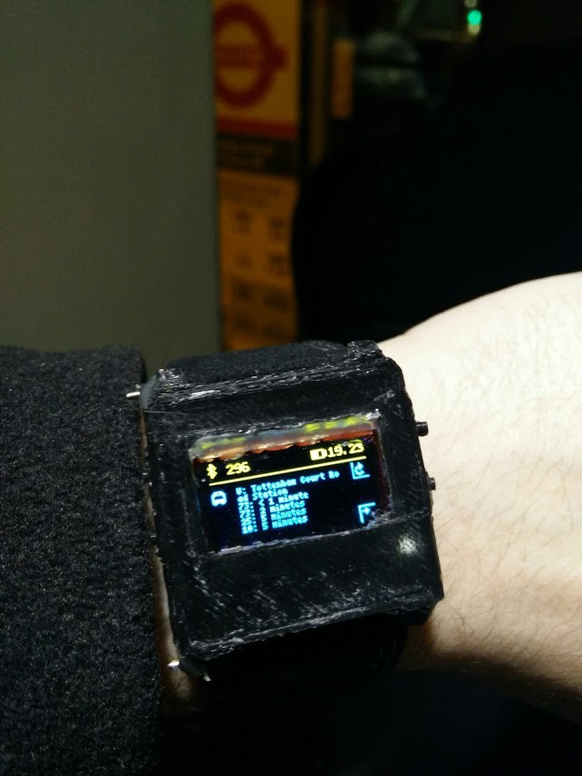
When you are waiting on a bus stop in the middle of winter in London you can't help but to wonder when your bus is due. And you want to do without taking your gloves off also! Wouldn't it be great to just know just by looking at your wristwatch?
Now you can, with WatchDuino2! We've built an app that will show a list of the next busses, with times, that will arrive at the bus stop where you are staing. When entering the watch app, WatchDuino will contact your Android phone to request for the bus info. Then the Android app with grab your geoposition and query the TFL API to compute your nearest bus stop and the times of the next buses arriving, and send that info back to the watch.
Discussions
Become a Hackaday.io Member
Create an account to leave a comment. Already have an account? Log In.