 Dan Julio
Version 3.2 of the Desktop application is available on my website. Existing users can use the "Check for updates" function to download it too.
It's a fairly minor update with a bug fix, slightly enhanced drawing performance and a couple of new features.
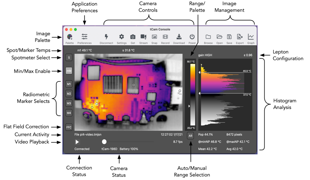
The main addition is the ability to display markers on the image at the location of the minimum and maximum temperature points. If enabled the min/max temps can be graphed as well.
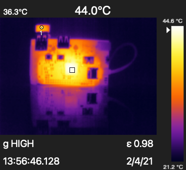
Marker temperatures are now also added to the exported images when enabled. The export image layout was tweaked a little to make it all fit.
I also fixed a bug where the markers were drawn in the wrong location for some exported image resolutions.
Mac Users can export mp4 video
I use a paid-for library from MonkeyBread Software to extend Xojo functionality. I have been using it for the mDNS functionality used to find cameras on the network. I noticed that it had a wrapper for Apple's AVfoundation framework. AVfoundation can create video files so I added the ability in the Mac version of the program to export mp4 video files from a tmjsn file. The mp4 export option shows up in the Save Dialog box when exporting a tmjsn file.
Sorry to the Windows and Linux users. I really want to figure out an export method for you too.
Discussions
Become a Hackaday.io Member
Create an account to leave a comment. Already have an account? Log In.