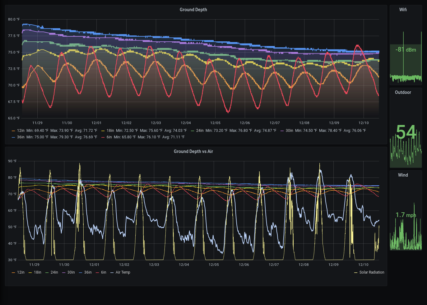
Well the basic question is this: Does the temperature of the ground impact the temperature of the air, and if so, how, and is it noticable? We have all heard of the "heat island" effect, but does that apply to the normal dirt that is everywhere on earth? Is a record high created by a process over a few weeks of ever-increasing ground temperatures, so that finally the overnight cooling just doesn't happen? I don't know, but I suspect it will take a year to find out.
What can we learn from the temperature underground
The ground changes temperature differently that the air. But does the ground influence the air? Can we measure that?
 Tim Rightnour
 Notice the *atrocious* wifi reception. Just barely good enough!


 lion mclionhead
 Kenji Larsen
You're right, I'm not measuring nearly enough. For example, my depth only goes to about 1m, I don't realistically have a way of digging deeper than that. I do have wind data, rain data, but am missing sky data right now. The graphs in grafana are a bit too unreadable if I throw all the other variables I measure into them, so alot of this will be gathering long periods of data, and then going back to the graphs and looking at them vs different factors, like humidity, etc etc.
One thing about doing this in Phoenix, and with the rather dense structure of the ground, is that there is virtually no water penetration at depth, so between 3" and 36" it's pretty much bone dry 365 days a year. IMHO this makes my set of variables a bit simpler, as the material's properties aren't changing day to day.
I think my short answer to the above is, I'm aware of most of what you said, but alot of this experiment is more along the lines of visualizing it myself, in an environment I understand. I've read papers and seen graphs of data, but it's always in a climate that is far different than mine, with soil and rain conditions that are far outside my daily norms. The idea of even having "soil" is insane to me. :)
I don't expect to make a scientific breakthrough here. More that I want to slightly understand the mechanism better in my own back yard. I think what I'm really curious about here is kind of similar to the concrete heat island effect. I live more or less on the outskirts of the city, so the quantity of concrete in my area is far lower, so I believe my air temperature is more influenced by ground than concrete. I'm wondering if I can predict "record high" type days, by looking at how the ground temp is moving. IE, where is the point where the overnight cooling simply cannot happen because the ground is buffering it up. Can I identify that?
I'd be glad of any references you have though. Part of this is gather what data I can for awhile, stare at it, and figure out what I'm missing, then figure out how to grab that data. The problem with weather projects is that your first data cycle takes a whole year. :)