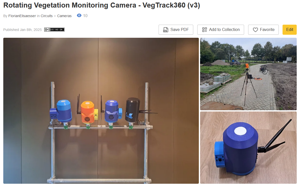
Extreme weather events - droughts, floods, and heatwaves - are becoming more frequent due to climate change, causing immense disruption to ecosystems and agriculture. These events drastically impact crop productivity, vegetation health, and biodiversity. Yet, the tools available for in-situ, high-resolution time-series monitoring are limited. Satellite imagery, while widely used, faces challenges like coarse spatial resolution, infrequent overpasses, and cloud interference during critical events.
The VegTrack360 (or vt360), a simple but powerful open-source solution designed to fill this gap. This innovative system can monitor vegetation by capturing 360° panoramic images using a rotating camera platform. These images are processed into high-resolution 2D Panoramas and 3D area representations using the emulated stereo camera setup or making use of existing 3D representations such as Digital Surface Models (DSMs). By providing valuable 360 degree insights, the system empowers scientists, farmers, and citizens to track the impacts of extreme weather events on vegetation, paving the way for climate-smart agriculture.
This article is an updated version of the older Rotating Camera for Vegetation Mapping article.
Why VegTrack360?
VegTrack360 bridges the gap between satellite and on-the-ground monitoring systems, offering:
- High Temporal Resolution: Captures data at flexible intervals.
- High Spatial Resolution: Provides sub-meter detail, complementing satellite imagery.
- Cost-Effectiveness: An accessible solution for diverse users, from scientists to precision farmers.
- Versatility: Ideal for studying weather impacts on vegetation, tracking crop health, and supporting citizen science initiatives.
How It Works
- Rotating Camera System: Mounted on a post or building, the system captures panoramic images in multiple spectral bands. Sensors can be exchanged and mounting thermal or multispectral sensors is possible.
- Advanced Image Processing: Using the Jetson Nano's edge-computing capabilities, the images can be converted to panoramas using e.g. openCV.
- DIY and Self-Sufficient Design: The system is designed to be easily reproducible using very common and relatively cheap components.
Revolutionizing Environmental Monitoring
VegTrack360 enables continuous spatio-temporal monitoring of vegetation with applications across multiple fields, including:
- Agriculture: Crop monitoring for precision farming.
- Environmental Science: Tracking the impact of extreme weather on ecosystems.
- Citizen Science: Empowering communities to document vegetation changes and weather impacts in their local environments.
This project supports open science and citizen engagement by providing a well-documented, replicable workflow.
VegTrack360 is more than a tool; it’s a call to action. By equipping individuals and organizations with the power to monitor and analyze vegetation health, we’re creating a collaborative platform for innovation and resilience in the face of climate change.
Links and Resources
- GitHub Repository: Access the code and files to build your own VegTrack360 system.
- Instructables Build Guide: Step-by-step instructions to assemble the system (for RGB cameras) from scratch.
- 4TU.ResearchData Test Dataset: Explore sample datasets with raw images and processed panoramas.
Together, let’s create smarter tools for a sustainable future. 🌍
 Florian Ellsäßer