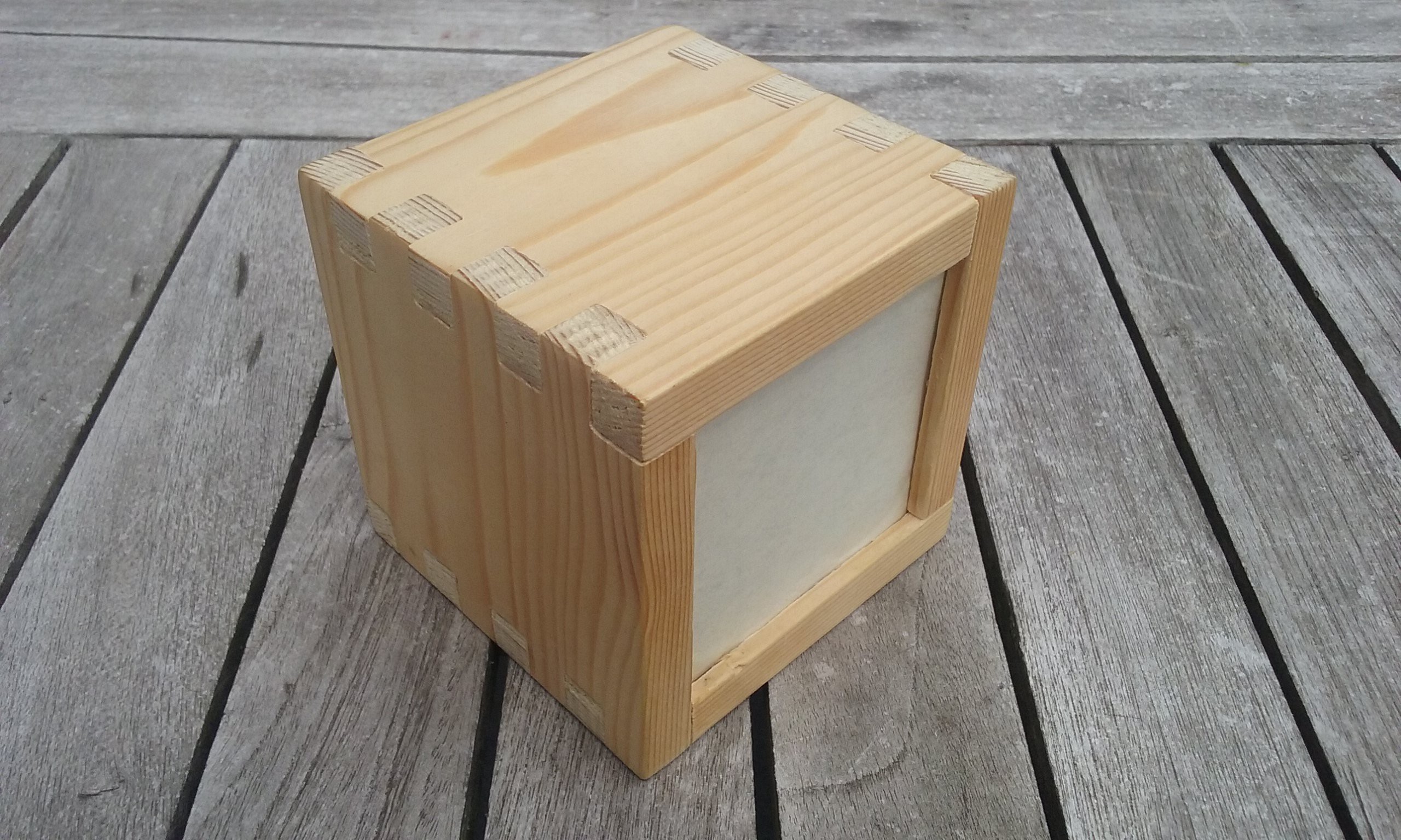
 Hopperpop
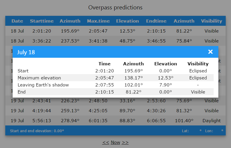
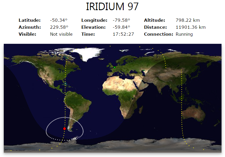
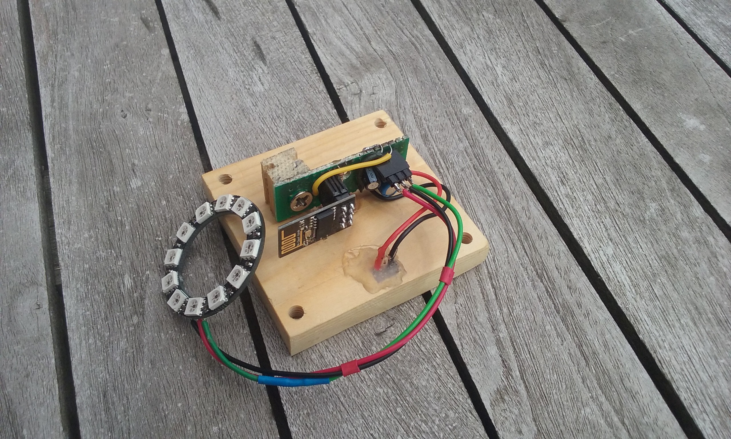
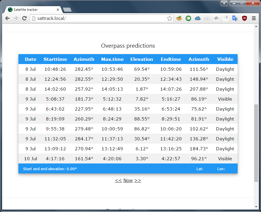
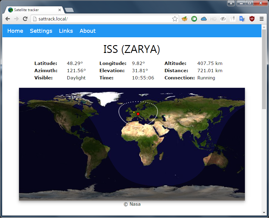
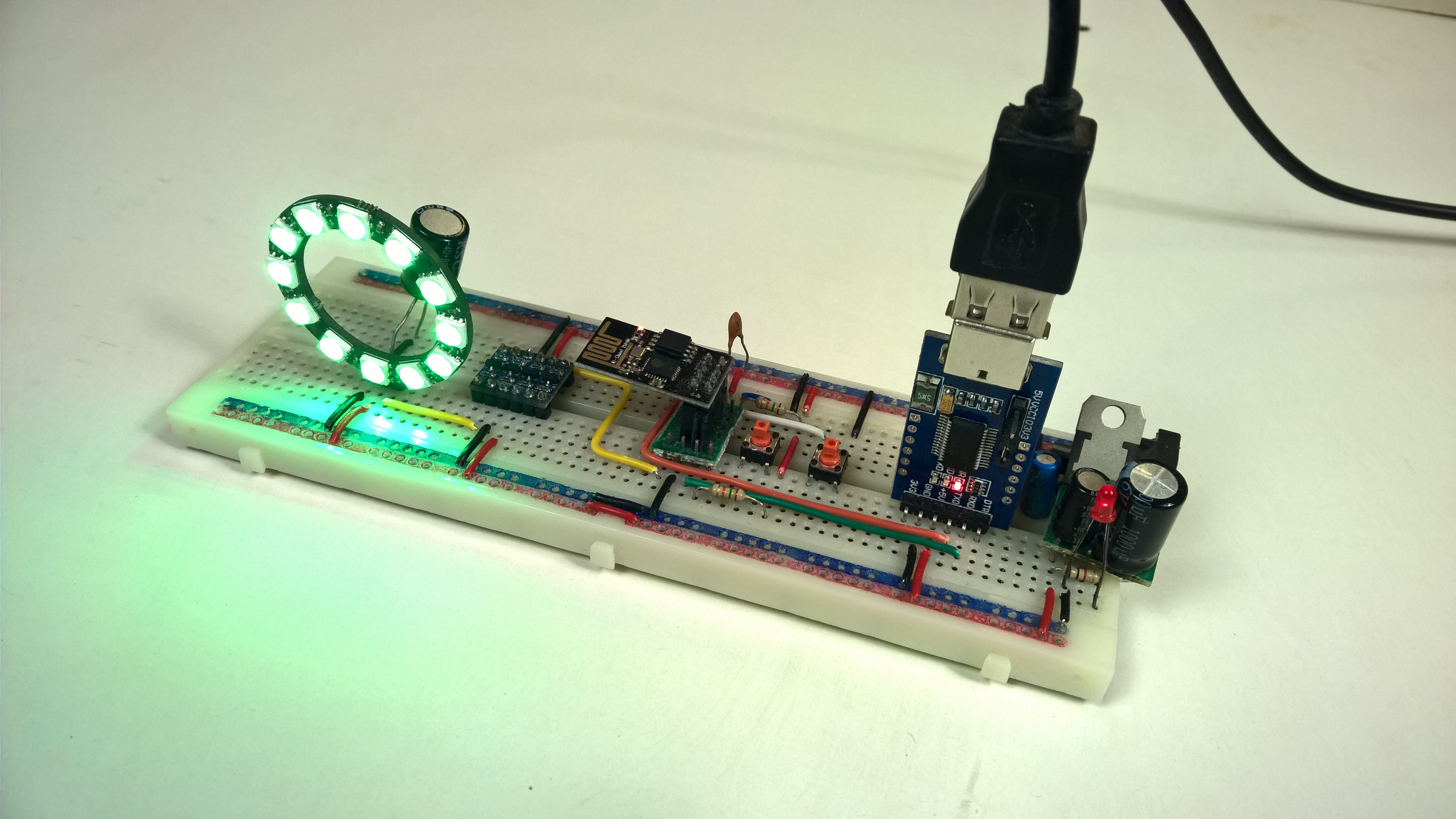
To know the current satellite position, the ESP8266 first gets a recent two-line element set from the web. Then it uses the SGP4 model to calculate the current satellite position. With the model and some extra algoritmes, it's able to tell if the satellite is in the earth shadow, and it can predict future overpasses. This information is display on the leds with a color scheme, and on a webpage with a web-socket.
The color changes depending on the elevation of the satellite and the type of overpass: daylight, eclipsed or visible.

(Note: Stellarium is used as a reference. There is no connection between Stellarium and the ESP8266.)
Summary of all it's features:
- Calculating satellite position and visibility.
- Predicting previous or future overpasses.
- Webserver for configuration and real-time information.
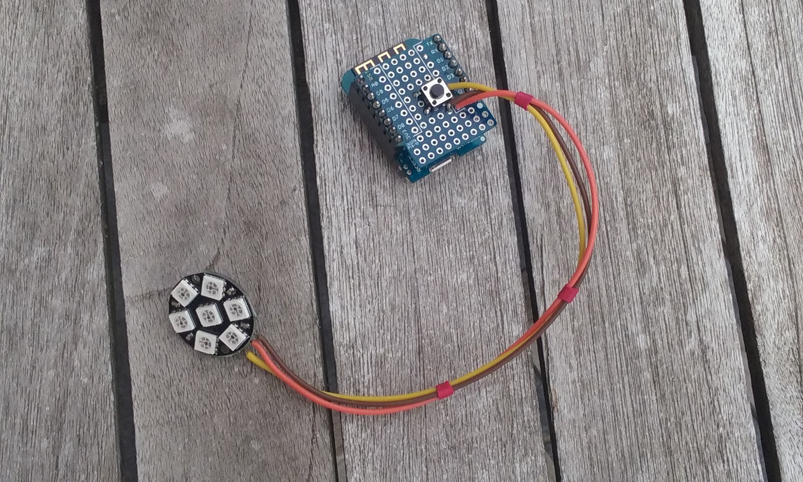
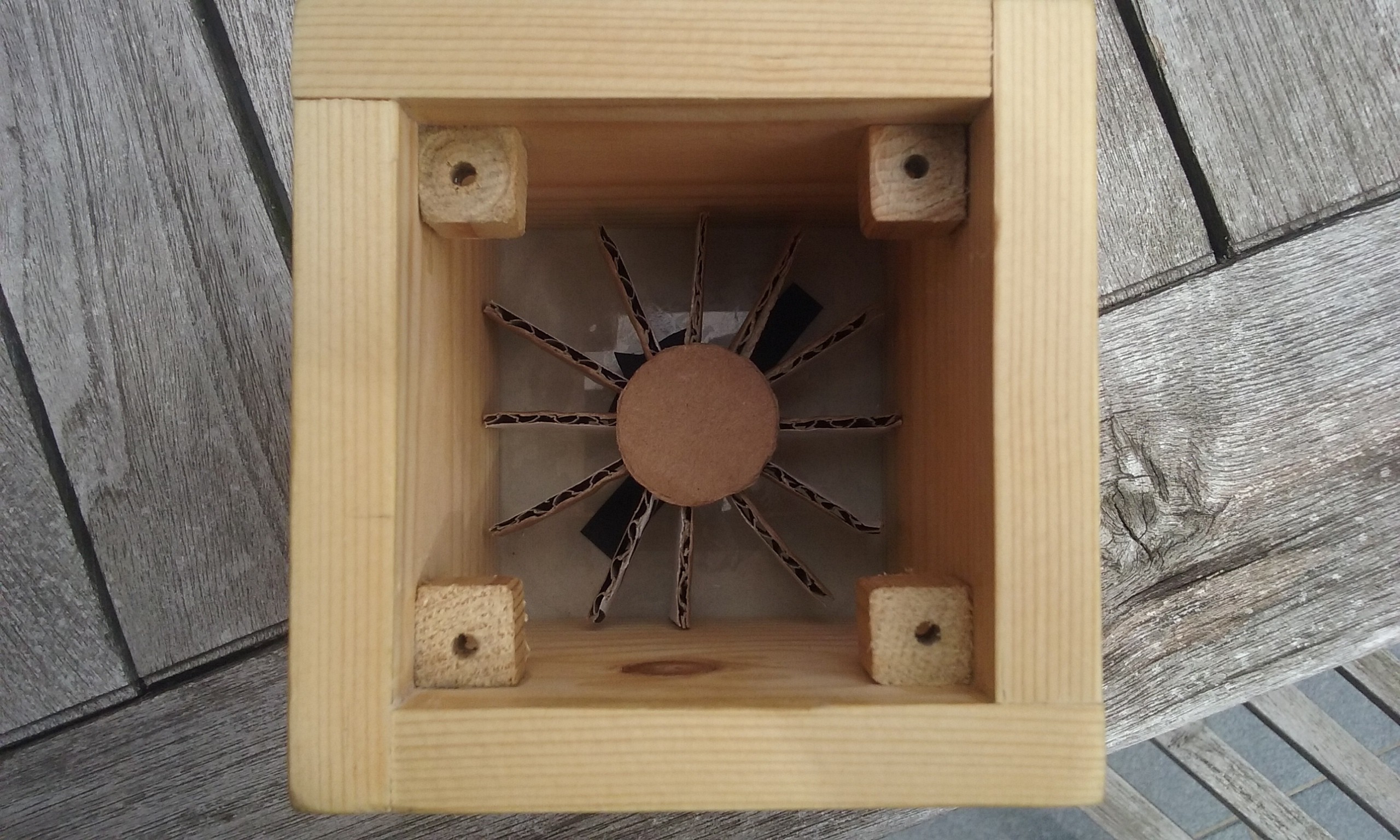
- Neopixels for warning the user when the satellite is overhead.

Hey ! I was able to upload the code (with Platform io) and the data-folder into SPIFF (with arduino IDE and the Data-upload plugin). The AP-mode works and I get connection. But the web page does not appear. Does anyone else have an idea or a tip? TX :-)
It works. A few minor adjustments were necessary in VSC. Great project. Thank you!