-
Tracking and Sensing
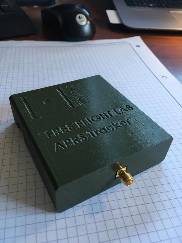
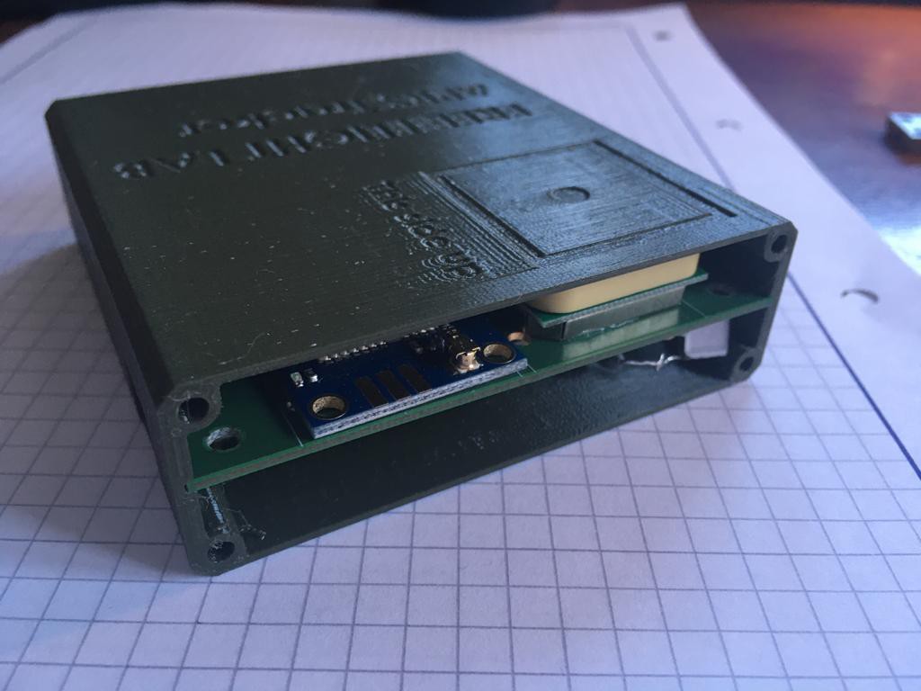
03/24/2021 at 18:45 • 0 commentsBecause the end goal is to capture atmospheric data and deliver it to those who might assimilate it into a better weather forecast. These units need both location information and environmental information. We have been working with a good friend in Munich who is a wizard!!! He developed these APRS trackers that we are really excited to test.
![]()
![]()
In other news, related, but also slightly not.. We launched a kickstarter for leather nose cones that protect your nose from the sun. Check it out. We would love your support, or at least a share with someone who loves the outdoors.
https://www.kickstarter.com/projects/freeflightlab/leather-nosecone
-
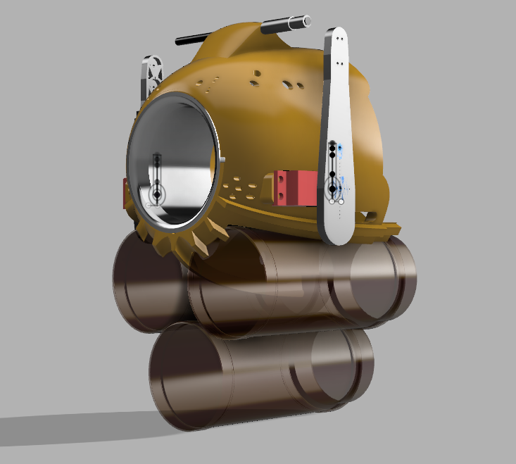
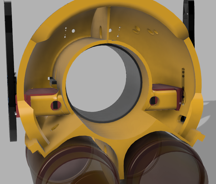
22hrs Later - Birdfish V5
02/07/2021 at 16:40 • 0 commentsFinal moments of printing.
-
After the Storm
02/02/2021 at 02:54 • 0 commentsIn the days after the storm the atmosphere can remain quite unstable. This becomes our playground.
First we hike the 2000 feet up to a launch at Mission Peak. I'm flying this day tandem on the Ozone Swiftmax.
Taking off we are able to find thermals that take us up to close to 4000ft. Our climbs are really only limited by the fact that we are reaching the clouds. It is possible to go higher, but not safely or legally in the US. I did try to get to the windward edge to surf/soar up the face of the cloud, but it didn't work this time.
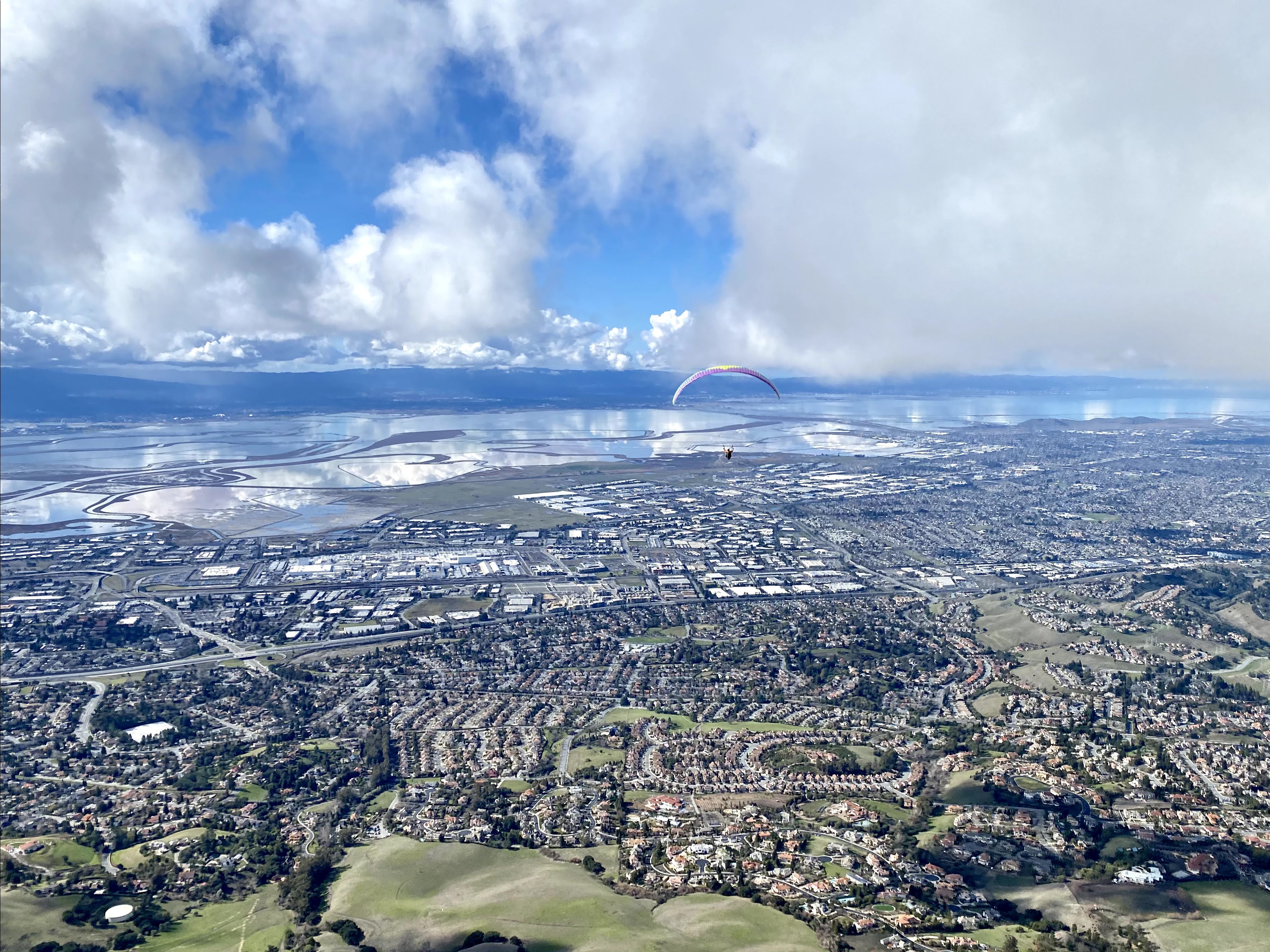
This picture is take right as we are trying to push forward to get cloud surfing.
![]()
Below us is Fremont, the Tesla Plant, 680 is the closer highway, and 880 is the one just a bit farther. Across the bay if you look carefully you can see both NASA Ames, and Shoreline Amphitheater. The color of the bay changes, there are some reddish brine ponds on the eastern shores closest in frame. To the immediate right of us are piles of salt.
A keen eye can see that there is very little wind. The bay is reflecting like a mirror.
Multi-million dollar homes scatter the hillside, but in some places large palaces loom above the others in private kingdoms on tiny mountains.
There is a white square and a white water tank in the lower left of the view both of these tend to be good trigger points for thermals. The Mission Blvd section of road cuts out a volume of airspace that my best guess is for the old glider port.
Warm springs BART is also in view.
Across the Bay you can see rain. Near Windy hill and Stanford (If you look close enough you can see Stanford Tower) as well as los altos.
The picture is taken by Bob, another paraglider pilot who climbed up in the same thermal as us.
We ended up flying down range to another park called Ed Levin, and almost landing twice on the way there, but we got low saves back to the clouds both times..
As Bob and Ismo (another pilot who is from Finland and doesnt mind the cold!) went down range, we decided to attempt to fly back to Mission Peak. We did it!!! Ismo and Bob went on to have amazing flights.
https://ayvri.com/scene/1q5r1p96k3/ckkiu9nfa00013b6gzw75q1ju
-
Raining - Re-Design
01/28/2021 at 00:17 • 0 commentsI need to carry more cargo, and sensors... mostly loading for the bigger wings.
It's raining again..
Want to learn a bit more? https://weatherwest.com/
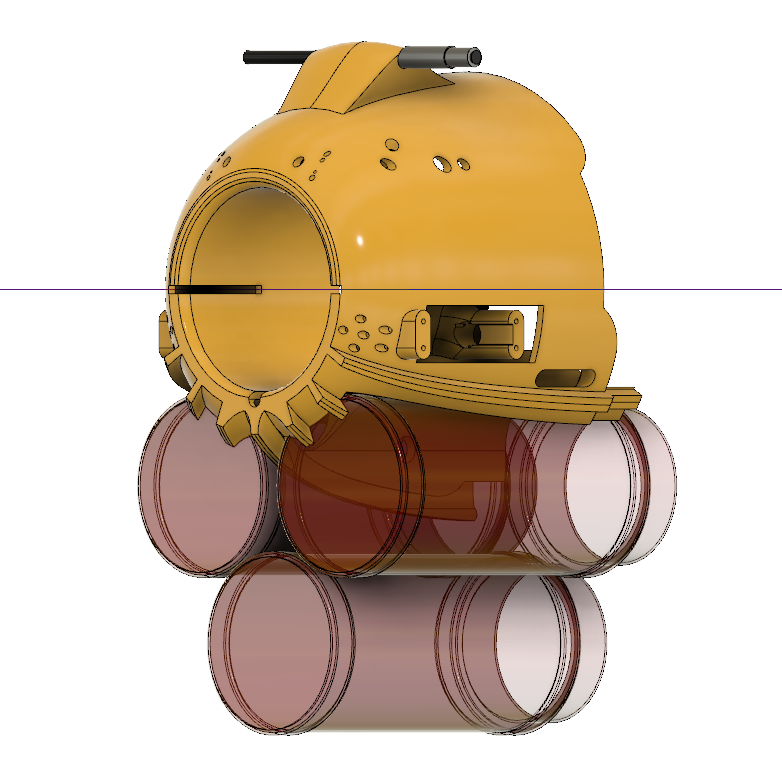
Anyway.. Here are some shots of the re-design. 3 Bragg's Nutritional Yeast Seasoning Configuration. ;)
I added reinforcement in the back, and took out the speed system for now.
-
EARTH
01/25/2021 at 16:19 • 0 commentsHere is the footage from the downward facing camera..
Its a wild ride, balanced with beautiful Earth views.
I love when its doing spirals. Could be a strange art installation on an old TV in a German art museum.
Then... as it flies away Earth shows up..
Oh this is not an old film of glitch footage.. This is real life.
Time Stamps are the same as the above upwards facing camera.
-
Weather, The Invisible Force (sometimes)
01/22/2021 at 20:24 • 0 commentsWell Today I planned to make some videos of testing one of the newest units..
After flying some RC planes in the field to warm up, all of the planes are 3d printed (https://www.eclipson-airplanes.com/airplanes)
It started to rain, in fact my maiden flight of a plane was in the rain.. Super fun, but no paraglider flight testing.The window we had was from 9-10am.
Weather.. I've devoted a lot of passion and energy since about 2010 into understanding our Earth's processes in greater detail. I like the limits of things, or to imagine where those limits might be..
2008 - Started sailing by repairing hurricane damaged boats and testing them...
2010 - Refocus Carbon Cycle Project at International Space University
2012 - Started Paragliding
2015 - Anticip8 - Weather Analytics Company Startup Incubator - Singularity University
2017 - Express 37' National Champions - Sailing.
2018-2020 - Monark - Weather Analytics, GNSSRO, Global Sensing at Scale | Airbus, Acubed Innovation Center
2020 - BBC Super Powered Eagles / PBS NOVA Eagle Power - Tandem Paragliding with Lloyd Buck
To me weather is a critical part of operating flying vehicles safely, and understanding it is the crux of getting global adoption of autonomy.
You must consider to your fullest extent of skill possible/available all risks that are present, or in a different way, potential opportunities for performance gains.
I love to sail and paraglide, both of these use no fuel, only sunlight and wind. Other vehicles can use this mindset to keep flying or to safely launch or land.
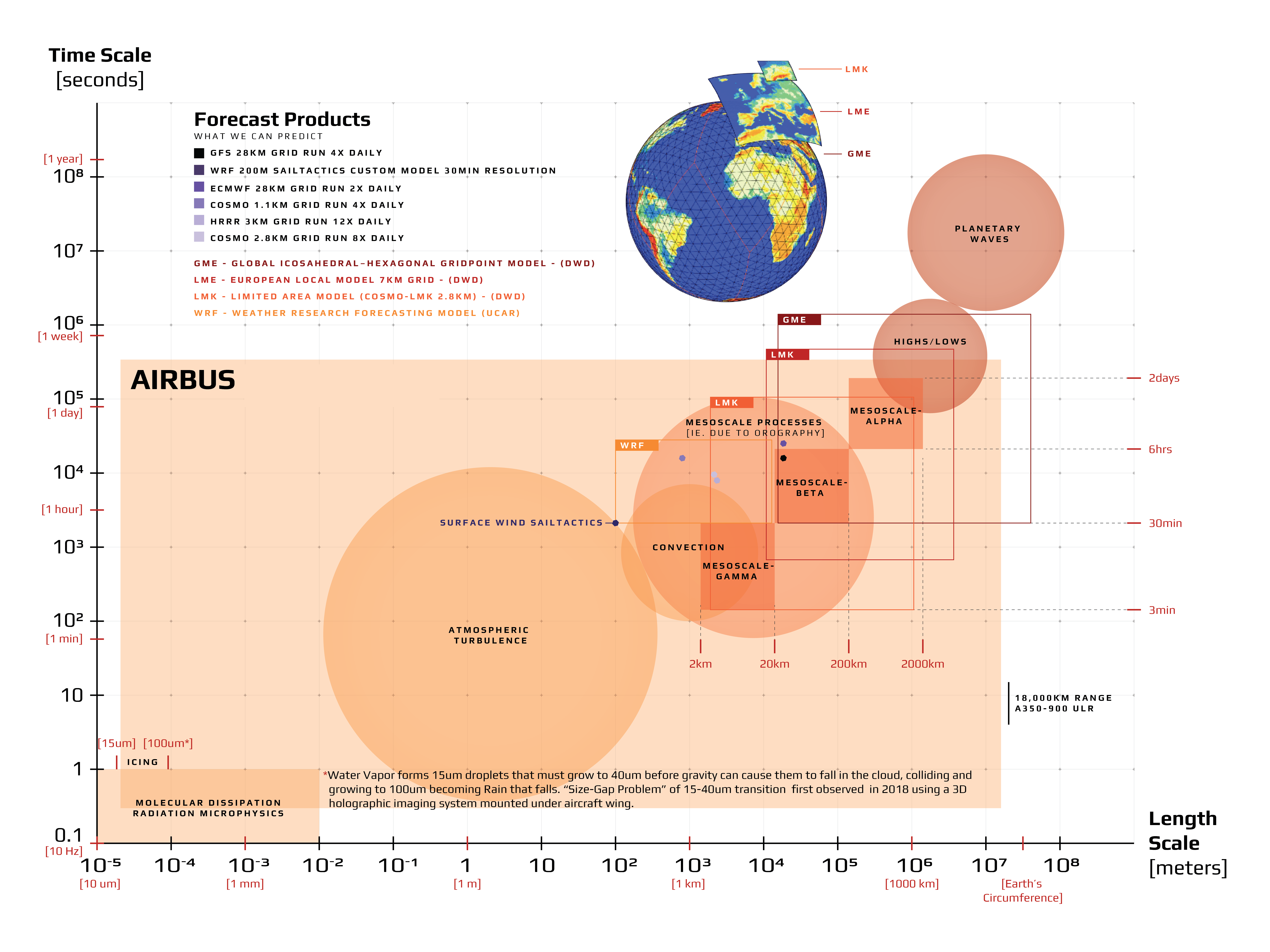
The topic of weather, and climate is difficult because it happens at various scales of time and dimension. Ok that sounds crazy, but how do I talk about the tiny flies that float in early morning sun around my plants in the same context as wind driven sea spray impacting the formation and trajectory of a hurricane.
This is also why it has been difficult to fully resolve the physics that go into computational analysis of weather and Earth processes. Things must be parameterized to be able to get an answer before the event occurs. Where is this limit..
![]()
There is a great statement from the book '2081 A hopeful view of the Human Future' - Gerard K O'Neill
-Von Neumann imagined that by the 1980s a very big electronic computer would be able to predict weather quite accurately. But weather prediction isn't a great deal better now than it was several decades ago. The atmosphere of Earth is enormous, a billion cubic miles in volume, and it reacts to sunlight, cloud cover, the exchange of heat with the oceans and the land, and even to the particles streaming off the sun. To make perfect predictions we'd need not only a computer of infinite speed and memory, but a system of sensing devices at every latitude, longitude, and altitude in the atmosphere, measuring at every moment the temperature, pressure, humidity, wind, airborne dust, and perhaps still other variables. In fact, measurements are only taken twice daily, and only at wildly scattered geographic locations. Over great areas of oceans, desert, and polar regions there are almost none at all. In reality, weather prediction can be affected more by a governmental decision to economize the number of air samples taken per day than by the advances in the speed and memory capacity of computers ------ 1980
Since 1980 there have been significant improvements in both ends of sensing and forecast skill. We have not rea yet reached the limit of what is possible. Many "advanced" uav projects and high altitude platforms focus on the technical aspects of design, and offering capability to customers. We see this is difficult as Loon was just shut down. The difference between 1000 platforms, and 10 are how well do you understand your ability to navigate and maintain flight aloft. This skill is massively correlated to weather and environment. Groups like Perlan 2.0 and HAPS platforms are discovering new phenomena in the high altitudes that are novel and yet to be understood. Sail drones are filling gaps in the oceans.. We all have a long way to go, and are far from the limit... So lets get into it!! The best part is each small improvement has cascading benefits to the well being of life on Earth.. bold statement.. maybe not.. Start to think about it.. from understanding drought cycles, as the Earth is dynamic, our ability to understand how what we observe will impact the near and potentially far future... we can better manage resources.
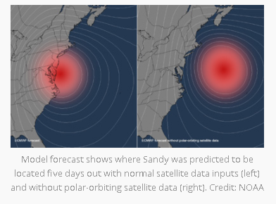
A good example of this is from Planet IQ. They did a study on hurricane Sandy, and noted that if the space assets of polar orbiting satellites were just a few less. 3 or so.. The forecast would have predicted that Sandy never made landfall and went out to sea.. we know this to not be true as what happened. Here is the source.
We are also finding new ways of discovering patterns and establishing models using different types of machine learning strategies .
Depending on what you care about and when; systems have gotten quite good.
For paragliding I use the HRRR and ECMWF forecasts, for sailing I use a custom one called sail tactics (Saildrones bought them). Many tools like https://www.windy.com/ help visualize both directional trends, and strength trends. I mostly look for timing and magnitude. When you are actually out in the field.. there is some correction.. That is the idea behind sensors and data assimilation. The forecast says 5mph, and 60degrees, but its 6mph and 62 degrees. Having TRUTH data in a timely fashion can help to tune, and re-establish warm start forecasts.
If weather is interesting to you please take a look at these free modules.. https://www.meted.ucar.edu/index.php You can sign up and learn basic to advanced meteorological concepts for free!!!
We need more sensing!!!!!Ill give an example. GNSS-RO measurements are used in data assimilation to improve weather forecasts today. Currently NOAA is seeking 20,000 measurements per day. They capture about 2,000-5,000 depending on a few different satellite constellations and some trial commercial partners. Over the last few years trial programs have gone from $100k, 700k, 1-3M.. now it is expected that these programs will be funded in the order of 22-24 Million dollars per year. https://spacenews.com/radio-occultation-ams-2020/
For weather balloons almost 1M dollars is spent per day releasing 2800 balloons globally. There are also aircraft based sensing programs AMDAR is one. There needs to be a lot more humidity measurements taken globally.
How can we increase sensing in a way that doesn't create trash, can recover expensive sensing systems, and or is bio-degradable and cheap...
A group that cares a lot about integrating new datasets into improving forecasts is JCSDA
or the Joint Center for Satellite Data Assimilation. They are not constrained to just space based sensing.
I can say a lot about this, but its part of the driver. I love to fly in thermals, they are moments of time, little bubbles of warm air, released by a tree, or a sheep running around.. Its crazy. No automated system gets to play like this yet.. When they do.. It will seem like magic, when its just Earth physics. ;)
-
Underloading Failures
01/18/2021 at 05:01 • 0 commentsWhen something works.. sometimes I move on.. sometimes I skip things.. well loading was a big one. Ill let you learn through all the videos of me excited to go test, and fly and.. well. failing..
All of these failures are mostly due to having the payload too light!! yeah i said it.. too light.... its like backwards airplane.. make things heavy and strong.. why.. because then you wont have to add batteries and steel to make it correct.
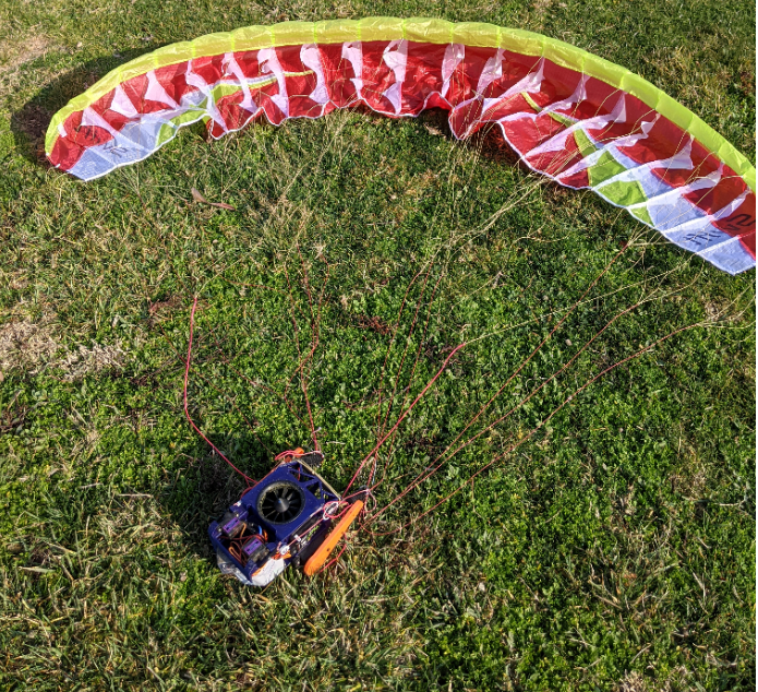
You will see 2 wings in this... the yellow is smaller than the white.. both.. i fail at...
After the first wings worked, I wanted to move right away to the larger higher performance ones. I totally underestimated the loading needed for them to fly properly.Glide Test
-
Flying the creation!
01/11/2021 at 23:45 • 0 commentsOk here is some flying footage. Of both the big servo and small servo units. As well as the center EDF Mario Bullet version3
-
EDF vs. Pusher Fan
01/11/2021 at 19:51 • 0 commentsThe goal of the project is free flight, so why mess around with motors. Well Simplicity. keep everything simple... simple... i hope.. simple..
I could either keep flying a two part system. Drop drone, drop plane, bridge, building, paraglider....
Or.. just fly up.. and test things with the throttle off. So.. 1 system it is.. can we keep it simple?
can we share it in a way that it is simple for others?? ugh... we will see.
what is the right thing to use... a large prop!!!! pusher... yea.. that is.. but why am I using EDF....
EDF are more power hungry and less efficient.
Why?
For Simplicity.
For Safety.
The goal is that anyone could handle, launch and recover.
![]()
In the end I needed to increase loading for the wings to work anyway, so extra batteries was not an issue.
I'm using 2 - 3S 1500mAh batteries. Sometimes I plug them in together for long flight times, other times just one at a time.
The original model I tested did have a pusher. It worked great. It also chopped lines... at least once.
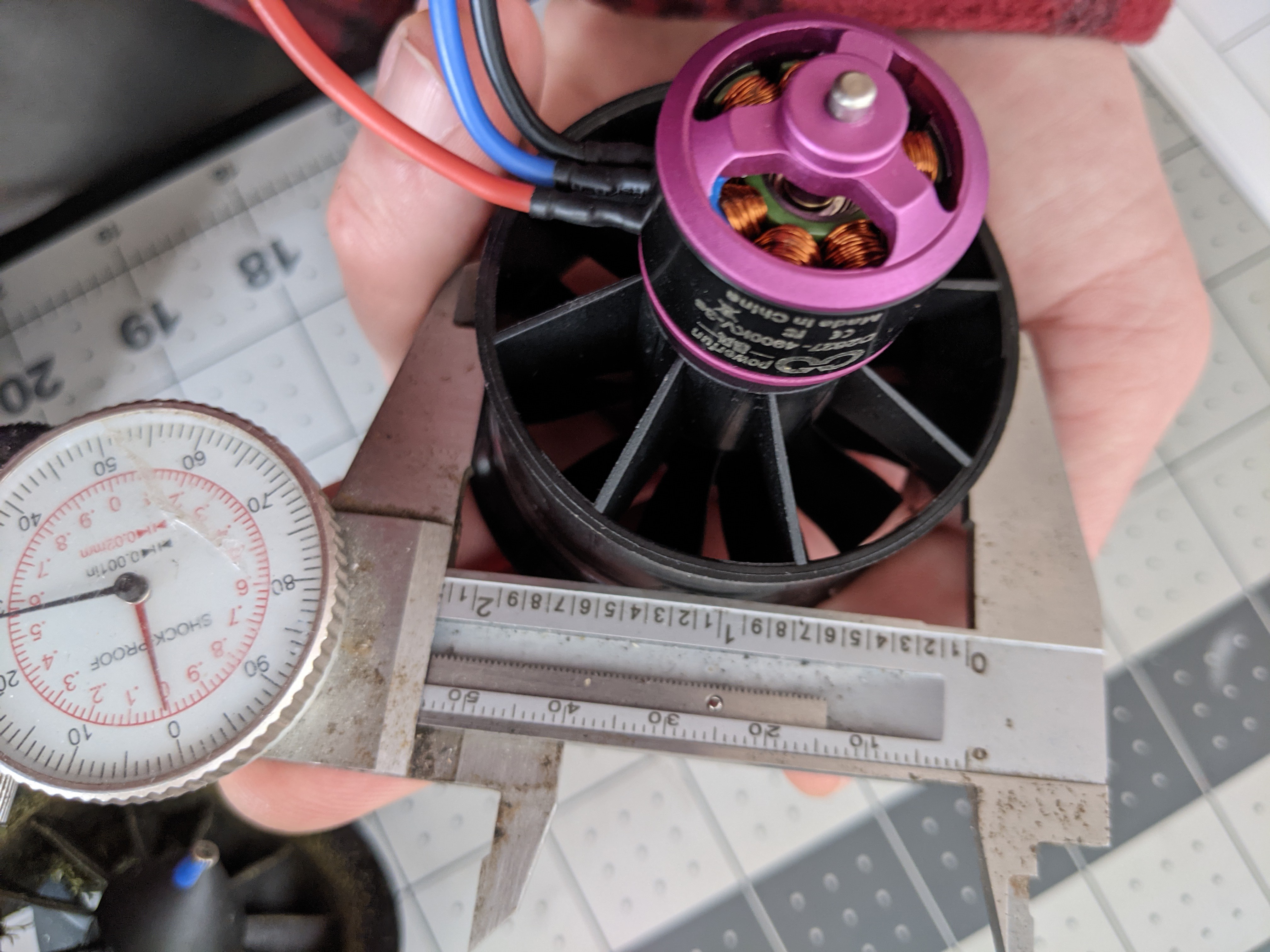
I have tried at least 3 sizes from 55mm to over 80mm. The large ones are loud and power hungry.
![]()
Small ones are sorta not super efficient, but do the job. So what is the thrust vector?! Right now its perpendicular to "vertical" along the X axis.
I have tried models pitching it down up to 10 degrees. It also requires finding the sweet spot of thrust, to moment.. to climb efficiently.
Well Id like to adjust it from where it is.. Mainly because it pitches back the system, and if the loading is not enough a stall will occur. To take care of this I add a bit of speed system just as I get off the ground.
I took it out today to test fly and get re-familiar with the unit so I can write these logs better.
To add to the fun. Bob was flying. He landed so perfectly. no flipping. Full brakes. Flare to ready to fly again. Congrats Bob.. well done.
-
Deployment Bag - Dbag
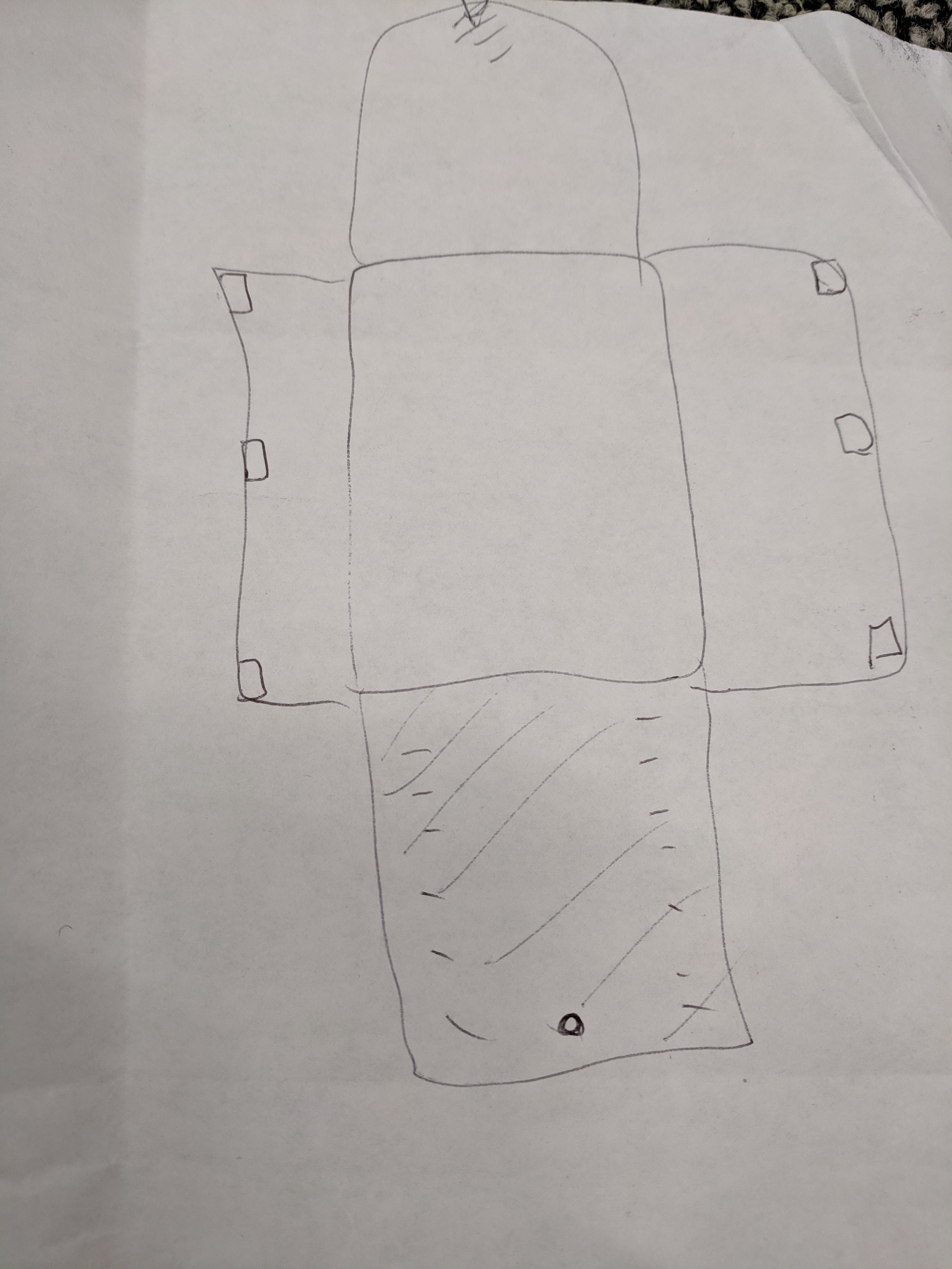
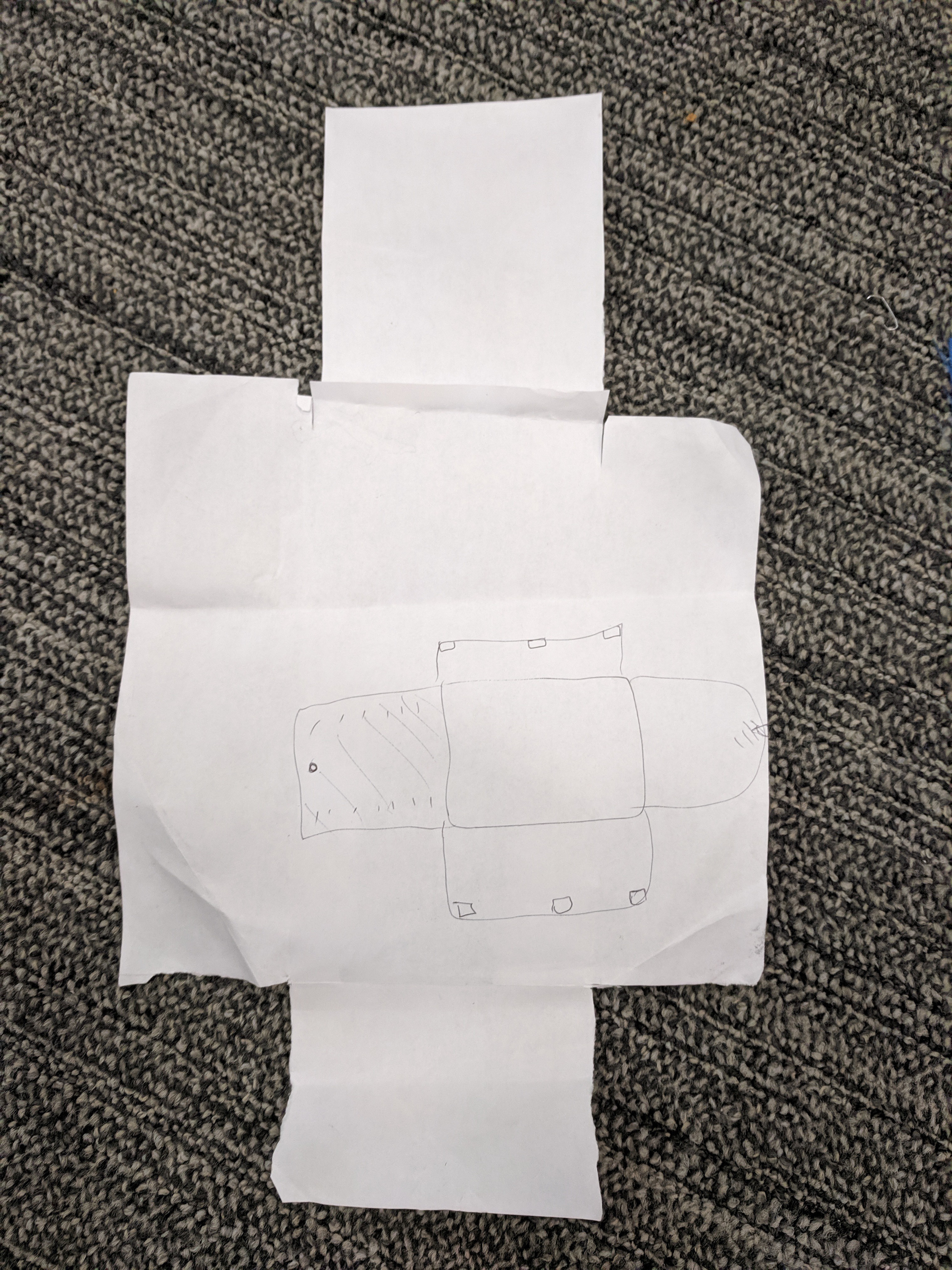
01/08/2021 at 17:59 • 0 commentsLearning from what works. What do humans do to jump out of things with paragliders and high aspect ratio wings.. its not like a parachute. One must avoid cravats and the lines are thinner. Not meant for shock inflation.
I based my design directly off of the JUSTAcro D-Bag designed by Pal Takats. I also used his packing method.
First drawing.
![]()
Made it out of paper next.
![]()
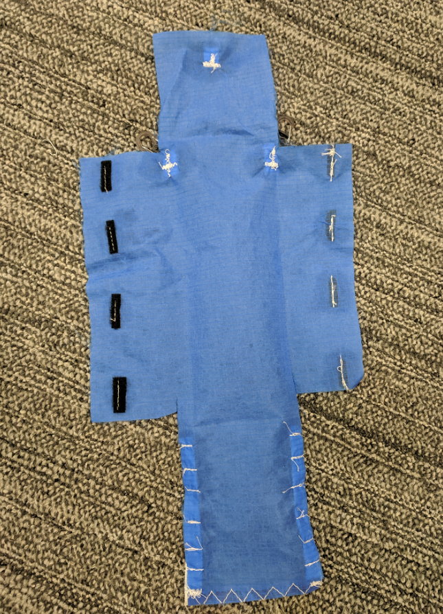
Outside of bag. Note attachment points Velcro direction. Flaps. And reinforcements on the line keeper flap
View of inside portion of bag.
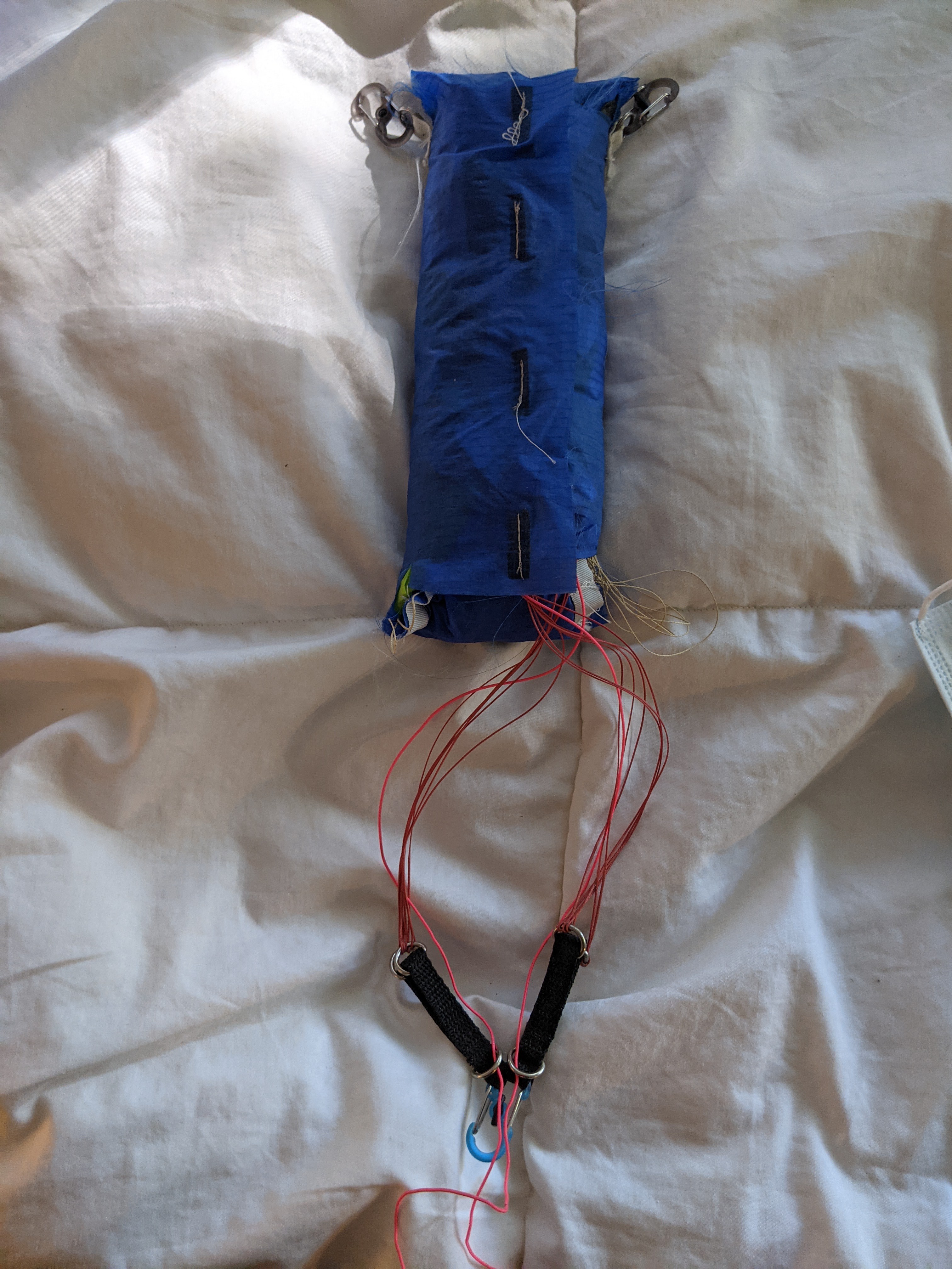
Packed
![]()
Project Bird Fish - Free Flight Robotics
Considerate conservation and climate science is on the horizon. These robots are developed to work in multi-species flocks for GOOD!
 freeflightlab