 Nick van de Giesen
Semifinals requirements:
a) Link to the new video
Present, see to the left below under "2015 Hackaday Prize Semifinals Video"
b) Update and add detail to info entered at the previous stages
Done, see blogs and GitHub repository.
c) Show at least eight (8) Project Log updates
Done, see below.
d) Post a near-complete (at least 90%) components list
Ready, see below
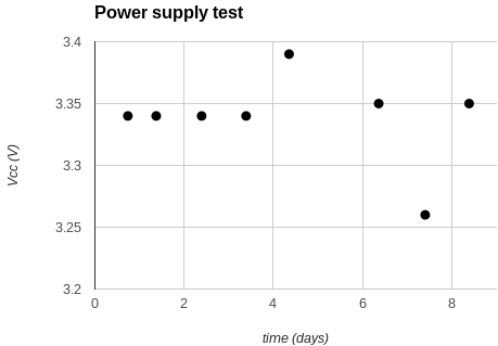
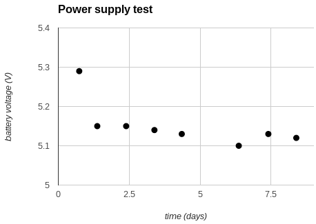
e) Post videos of your prototype in action
Done, see previous and new videos (link to the left)
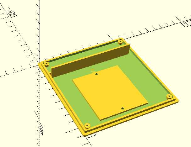
f) Post an artist’s rendition of the “productized” design/look and feel of the project
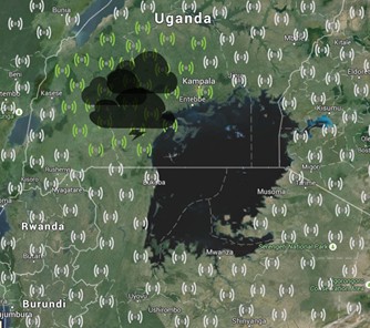
This map of Lake Victoria is our artist's rendition of how the overal product should work. Stations detect lightning strokes, time this accurately through the GPS, and measure the associated energy. On the basis of these measurements, we will trilaterate the exact location of heavy thunder storms and produce early warnings.
For technical details, see:
https://github.com/nvandegiesen/Team_TAHMO/wiki
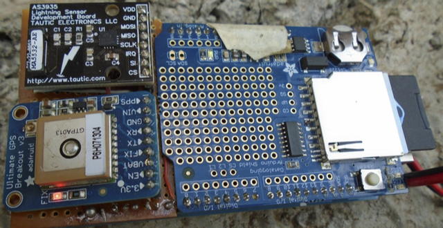
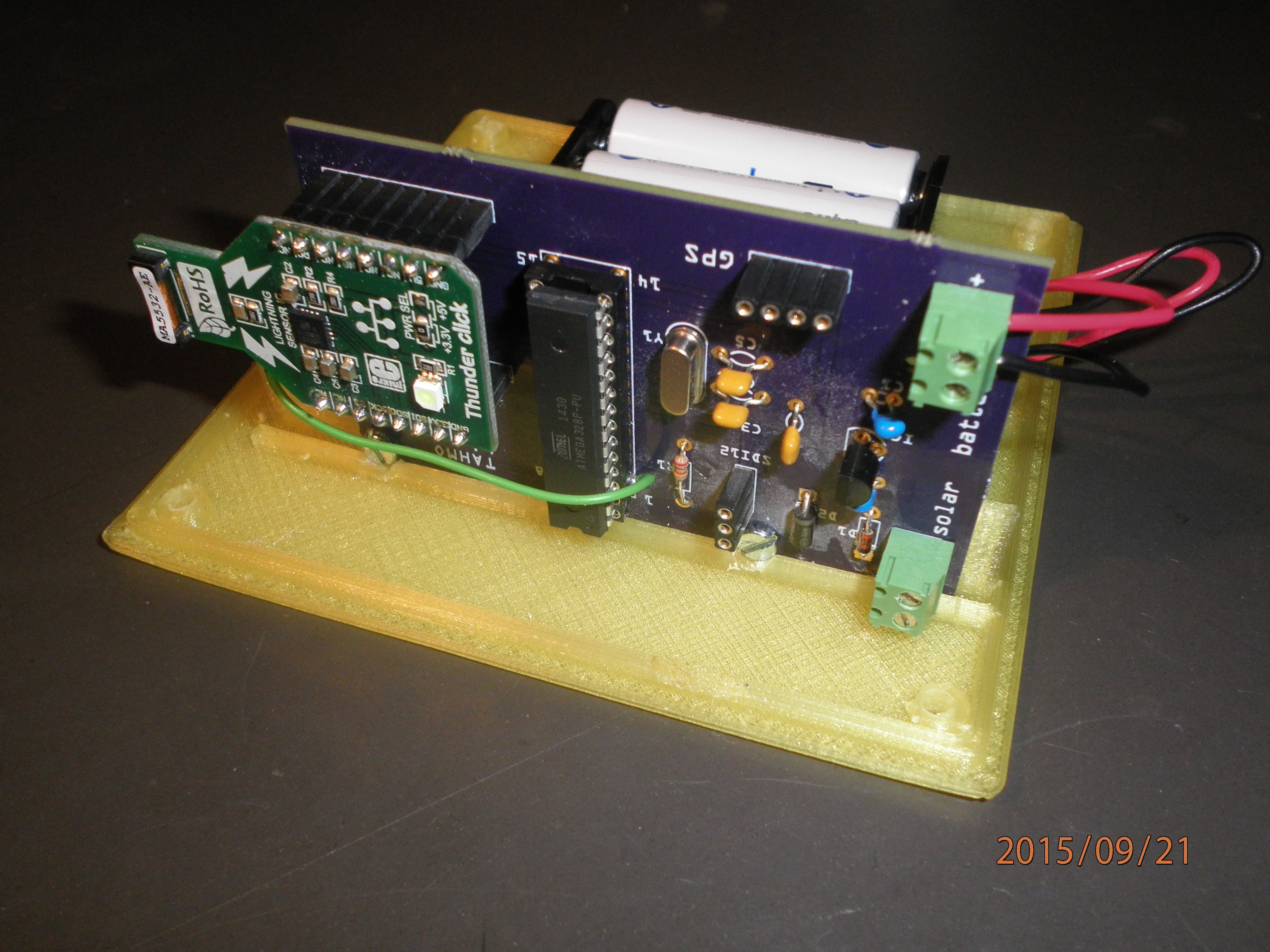
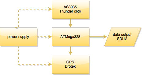
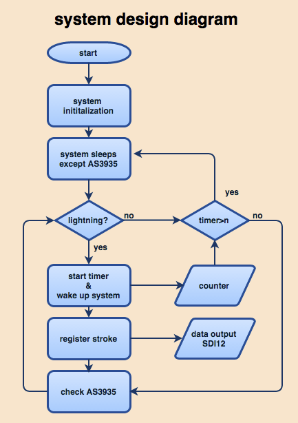
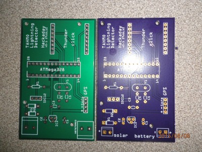
The AS3935 Franklin Lightning sensor has been designed for inclusion in consumer devices such as watches, fitness trackers, etc. The sensor provides warnings about approaching lightning storms by providing the distance to nearby strikes. When deployed in a network, one can map the actual lightning position though trilateration. Gilbert Mwangi built a proof of concept that mapped lightning around Nairobi. An article about this can be found here: http://eserver.kabarak.ac.ke:8082/ojs/index.php/journal1/article/view/28/9. In the present project, we will develop this concept further, move to a low power ATmel MCU, and design the PCB.
GPS Atmospheric Moisture
The standard use of a GPS is providing users with their geographical position. The GPS signal is affected by moisture in the atmosphere. Because our stations are (mainly) stationary, we can analyze the signal to extract information about atmospheric moisture. Such information is important for improved weather forecasts as it gives the "total precipitable water column". See, for example, "GPS Meteorology: Direct Estimation of the Absolute Value of Precipitable Water". Recent improvements in GPS devices allow us to perform this analysis with affordable GPS devices. Because we already need a GPS for the timing of the lightning strikes, this is a "free" add-on.
Background & State-of-the-Art
TAHMO stands for "Trans-African Hydro-Meteorological Observatory", a program that aims to design, build, deploy, and operate a network 20,000 weather stations in sub-Saharan Africa (www.tahmo.org). Presently, we have pilot stations in Senegal, Chad, Nigeria, Uganda, and South Africa and "pilots at scale" in Ghana and Kenya.
TAHMO stations have to be be affordable and robust. For example, unlike standard weather stations, there should not be any moving parts as these are quickly affected by dust and insects. Maintenance so be limited to some simple cleaning. The network makes use of the availability of cell-phone coverage that has reached most of Africa over the past decade.
Presently, we work with stations developed by Decagon that come close to TAHMO specs. These stations cover all standard meteo measurements such as air temperature and relative humidity, wind speed and direction, incoming solar radiation, and barometric pressure.
The aim of the Team TAHMO Hackaday project is to add some very useful advanced sensing capabilities, based on existing consumer electronics.
Presently, we are thinking of:
- Lightning sensors
- GPS derived atmospheric moisture
- Large scale soil moisture
The team is based on participants of the first TAHMO Sensor Design Competition.
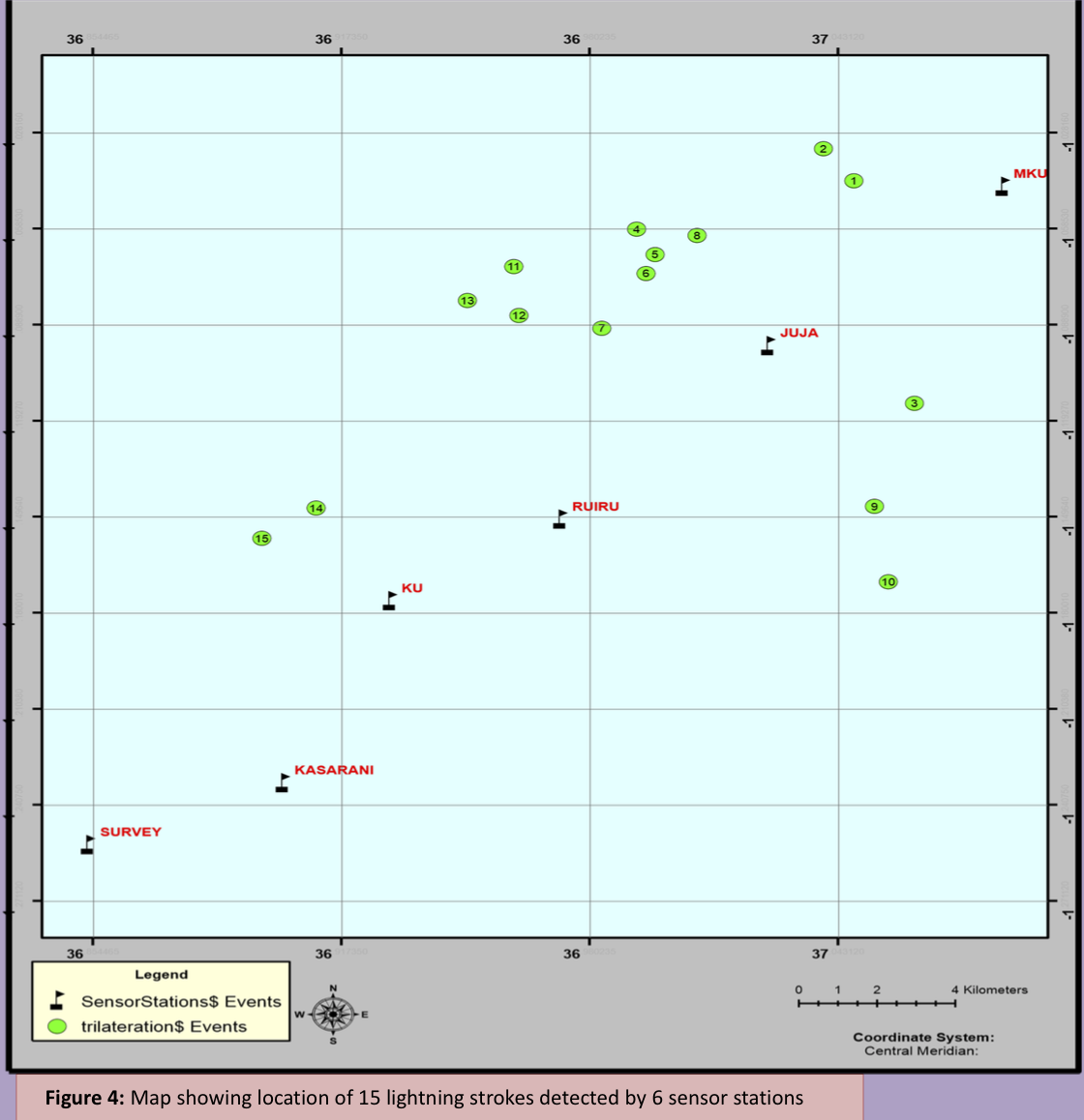 First results of lightning multi-lateration around Nairobi, Kenya with early standalone prototypes.
 This map shows the present TAHMO stations around Lake Victoria, which will be used to install the lightning sensors and GPS receivers.


 Ben Brown
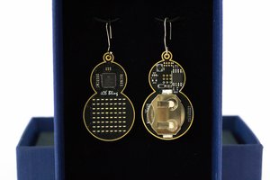
 Mahesh Venkitachalam
 CiferTech
 Kevin Jablonski
Under "Lightning Sensors" you have a defective ink to a magazine article ... http://eserver.kabarak.ac.ke:8082/ojs/index.php/journal1/article/view/28/9.
Any idea where it moved to?
Tom